Harrison Lake State Park: Difference between revisions
Appearance
Content deleted Content added
Harold Angel (talk | contribs) add refs, links, ce |
Zackmann08 (talk | contribs) Converting to use Template:Infobox protected area |
||
| Line 1: | Line 1: | ||
{{ |
{{Infobox protected area |
||
| ⚫ | |||
<!-- *** Name section *** --> |
|||
| iucn_category = |
|||
| ⚫ | |||
| |
| iucn_ref = |
||
<!-- |
<!-- images --> |
||
| |
| photo = Picnic site at Harrison Lake State Park, Ohio.JPG |
||
| photo_caption = |
|||
| category_iucn = |
|||
<!-- |
<!-- map --> |
||
| |
| map = USA Ohio |
||
| |
| map_image = |
||
| |
| map_size = 280 |
||
| ⚫ | |||
| etymology_type = Named for |
|||
| ⚫ | |||
| ⚫ | |||
<!-- |
<!-- location --> |
||
| |
| location = [[Fulton County, Ohio|Fulton]], Ohio, United States |
||
| |
| nearest_city = |
||
| nearest_town = |
|||
| region_type = County |
|||
| ⚫ | |||
| region = [[Fulton County, Ohio|Fulton]] |
|||
| ⚫ | |||
| district_type = |
|||
<!-- stats --> |
|||
| district = |
|||
| |
| length = |
||
| length_mi = |
|||
| city1 = |
|||
| length_km = |
|||
<!-- *** Geography *** --> |
|||
| width = |
|||
| ⚫ | |||
| width_mi = |
|||
| ⚫ | |||
| |
| width_km = |
||
| area_acre = 142 |
|||
| elevation_imperial = 774 |
|||
| ⚫ | |||
| elevation_round = 0 |
|||
| |
| elevation = {{convert|774|ft|m|abbr=on}}<ref name=gnis>{{cite gnis|1056315|Harrison Lake State Reservation}}</ref> |
||
| |
| elevation_avg = |
||
| |
| elevation_min = |
||
| |
| elevation_max = |
||
| dimensions = |
|||
| ⚫ | |||
| designation = |
|||
| area1_imperial = |
|||
| ⚫ | |||
| area1_type = |
|||
| |
| authorized = |
||
| created = |
|||
| length_imperial = | length_orientation = | width_imperial = | width_orientation = |
|||
| designated = |
|||
| highest = | highest location = | highest_elevation_imperial = |
|||
| ⚫ | |||
| lowest = | lowest_location = | lowest_elevation_imperial = |
|||
| ⚫ | |||
| ⚫ | |||
| visitation_num = |
|||
| biome = | biome_share = | biome1 = | biome1_share = |
|||
| visitation_year = |
|||
| geology = | geology1 = |
|||
| visitation_ref = |
|||
| plant = | plant1 = | animal = | animal1 = |
|||
| ⚫ | |||
<!-- *** People *** --> |
|||
| administrator = |
|||
| established_type = Established |
|||
| |
| operator = |
||
| owner = |
|||
| ⚫ | |||
<!-- website, embedded --> |
|||
| established1_type = |
|||
| ⚫ | |||
| established1 = |
|||
| embedded = |
|||
| ⚫ | |||
| management_location = |
|||
| management_elevation = |
|||
| visitation = | visitation_year = |
|||
| free_type = | free = | free1_type = | free1 = |
|||
<!-- *** Map section *** --> |
|||
| ⚫ | |||
| ⚫ | |||
| pushpin_map_size = 280 |
|||
<!-- *** Website *** --> |
|||
| ⚫ | |||
}} |
}} |
||
Revision as of 03:15, 12 November 2018
| Harrison Lake State Park | |
|---|---|
 | |
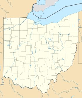
| Location | Fulton, Ohio, United States |
| Coordinates | 41°38′37″N 84°22′20″W / 41.64361°N 84.37222°W[1] |
| Area | 142 acres (57 ha)[2] |
| Elevation | 774 ft (236 m)[1] |
| Established | 1950[3] |
| Named for | William Henry Harrison |
| Governing body | Ohio Department of Natural Resources |
| Website | Harrison Lake State Park |
Harrison Lake State Park is a 142-acre (57 ha) state park located southwest of Fayette, Ohio, established in 1950.[2] The park offers a 3.5-mile hiking trail, 150-foot swimming beach, and a campground with 181 campsites.[4]
Harrison Lake covers 95 acres (38 ha). It was artificially created with the damming of Mill Creek, a tributary to the Tiffin River, in 1939. The maximum depth is over fifteen feet near the dam. Fish include bluegill, channel catfish, largemouth bass, white crappie and bullhead.[5]
A 4-H camp located by the lake offers access to the water for its campers.[6]
References
- ^ a b "Harrison Lake State Reservation". Geographic Names Information System. United States Geological Survey, United States Department of the Interior.
- ^ a b "Harrison Lake State Park". Ohio Department of Natural Resources. Retrieved November 14, 2017.
- ^ "Harrison Lake State Park: History". Ohio Department of Natural Resources. Retrieved November 14, 2017.
- ^ "Harrison Lake State Park: Activities". Ohio Department of Natural Resources. Retrieved November 14, 2017.
- ^ "Harrison Lake". Ohio Department of Natural Resources Division of Wildlife. Retrieved November 14, 2017.
- ^ 4-H Camp Palmer
External links
- Harrison Lake State Park Ohio Department of Natural Resources
- Harrison Lake State Park Map Ohio Department of Natural Resources
Wikivoyage has a travel guide for Ohio State
Parks that includes
Harrison Lake State Park.
Parks that includes
Harrison Lake State Park.

