Hat Island (Wisconsin): Difference between revisions
Appearance
Content deleted Content added
m added {{Lake Michigan Islands}} |
fixing deprecated params from Template:Infobox islands - ZackBot 12 - Approved |
||
| Line 1: | Line 1: | ||
{{Infobox islands |
{{Infobox islands |
||
| name = Hat Island |
| name = Hat Island |
||
| |
| native_name = <!-- or |local_name= --> |
||
| |
| native_name_link = |
||
| native_name_lang = |
| native_name_lang = |
||
| sobriquet = <!-- or |nickname= --> |
| sobriquet = <!-- or |nickname= --> |
||
| |
| image_name = |
||
| |
| image_size = |
||
| |
| image_caption = |
||
| |
| image_alt = |
||
| |
| map_alt = |
||
| |
| map_size = |
||
| |
| map_caption = |
||
| pushpin_map = USA Wisconsin |
| pushpin_map = USA Wisconsin |
||
| pushpin_label = |
| pushpin_label = |
||
| Line 24: | Line 24: | ||
| archipelago = |
| archipelago = |
||
| waterbody = |
| waterbody = |
||
| |
| total_islands = |
||
| |
| major_islands = |
||
| |
|area_acre = 8 |
||
| |
| area_footnotes = |
||
| rank = |
| rank = |
||
| |
| length_mi = <!-- or |length_ft= --> |
||
| |
| length_footnotes = |
||
| |
| width_mi = <!-- or |width_ft= --> |
||
| |
| width_footnotes = |
||
| |
| coastline_mi = <!-- or |coastline_ft= --> |
||
| |
| coastline_footnotes = |
||
| |
| elevation_ft = 581 |
||
| |
| elevation_footnotes = |
||
| |
| highest_mount = |
||
| country = United States |
| country = United States |
||
| |
| country_admin_divisions_title = |
||
| |
| country_admin_divisions = |
||
| |
| country_admin_divisions_title_1 = |
||
| |
| country_admin_divisions_1 = |
||
| |
| country_admin_divisions_title_2 = |
||
| |
| country_admin_divisions_2 = |
||
| |
| country_capital_type = |
||
| |
| country_capital = |
||
| |
| country_largest_city_type = |
||
| |
| country_largest_city = |
||
| country_capital_and_largest_city = |
|||
| country capital and largest city = |
|||
| |
| country_largest_city_population = |
||
| |
| country_leader_title = |
||
| |
| country_leader_name = |
||
| |
| country_area_sqmi = <!-- or |country_area_sqft= or |country_area_acre= --> |
||
| |
| country_1 = |
||
| |
| country_1_admin_divisions_title = |
||
| |
| country_1_admin_divisions = |
||
| country_1_admin_divisions_title_1 = |
|||
| country 1 admin divisions title 1 = |
|||
| |
| country_1_admin_divisions_1 = |
||
| |
| country_1_capital_type = |
||
| |
| country_1_capital = |
||
| |
| country_1_largest_city_type = |
||
| |
| country_1_largest_city = |
||
| country_1_capital_and_largest_city = |
|||
| country 1 capital and largest city = |
|||
| country_1_largest_city_population = |
|||
| country 1 largest city population = |
|||
| |
| country_1_leader_title = |
||
| |
| country_1_leader_name = |
||
| |
| country_1_area_sqmi = <!-- or |country_1_area_sqft= or |country_1_area_acre= --> |
||
| demonym = |
| demonym = |
||
| population = |
| population = |
||
| |
| population_as_of = |
||
| population_footnotes = |
|||
| population footnotes = |
|||
| |
| population_rank = |
||
| population_rank_max = |
|||
| population rank max = |
|||
| |
| density_sqmi = |
||
| |
| density_rank = |
||
| |
| density_footnotes = |
||
| |
| ethnic_groups = |
||
| timezone1 = |
| timezone1 = |
||
| utc_offset1 = |
| utc_offset1 = |
||
| Line 83: | Line 83: | ||
| utc_offset1_DST = |
| utc_offset1_DST = |
||
| website = |
| website = |
||
| |
| additional_info = |
||
| footnotes = |
| footnotes = |
||
}} |
}} |
||
Revision as of 19:24, 19 November 2018
| Geography | |
|---|---|
| Location | Green Bay |
| Coordinates | 45°06′08″N 087°19′04″W / 45.10222°N 87.31778°W |
| Area | 8 acres (3.2 ha) |
| Highest elevation | 581 ft (177.1 m) |
| Administration | |
United States | |
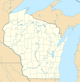
Hat Island is an island in Green Bay in Door County, Wisconsin.[1] The island is part of the Town of Gibraltar, and lies offshore from the community of Juddville.[2] Hat Island is privately owned.[3]
References
- ^ "GNIS". Geographic Names Information System. USGNIS. Retrieved 18 September 2017.
- ^ Wisconsin Department of Transportation-Door County, Wisconsin map
- ^ Slattery, Sally. "The History of Door County's Islands". Door County Pulse. Retrieved September 18, 2017.


