Kum (mountain): Difference between revisions
Appearance
Content deleted Content added
Rescuing 1 sources and tagging 0 as dead. #IABot (v1.3) |
m Robot - Speedily moving category Mountains in Lower Carniola to Category:Mountains of Lower Carniola per CFDS. |
||
| Line 31: | Line 31: | ||
{{Trbovlje |state=collapsed}} |
{{Trbovlje |state=collapsed}} |
||
[[Category:Mountains |
[[Category:Mountains of Lower Carniola]] |
||
[[Category:Municipality of Trbovlje]] |
[[Category:Municipality of Trbovlje]] |
||
[[Category:One-thousanders of Slovenia]] |
[[Category:One-thousanders of Slovenia]] |
||
Revision as of 08:36, 22 December 2018
You can help expand this article with text translated from the corresponding article in Slovene. (December 2011) Click [show] for important translation instructions.
|
| Kum | |
|---|---|
 The church and transmitter at the top of Kum | |
| Highest point | |
| Elevation | 1,220 m (4,000 ft)[1] |
| Coordinates | 46°5′16.28″N 15°4′22.72″E / 46.0878556°N 15.0729778°E[1] |
| Geography | |
 | |
| Location | Slovenia |
| Parent range | Sava Hills |
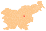
Kum (pronounced [ˈkuːm]; Template:Lang-de[2]) is the highest peak in the Slovenian Sava Hills. Its summit is at 1,220 m above sea level. The mountain is also called the "Sava Triglav" because it is the highest peak in the region. There are a number of structures at the summit, notably a church dedicated to Saint Agnes from the 17th century and a transmitter. It belongs to the settlement of Ključevica.
See also
References
External links
 Media related to Kum at Wikimedia Commons

