Svartisen: Difference between revisions
added photo depicting the area during summer |
add reference, pics, misc cleanup |
||
| Line 1: | Line 1: | ||
{{Infobox glacier |
{{Infobox glacier |
||
| |
|name = Svartisen |
||
|other_name = |
|||
| photo = Svartisen glacier.JPG |
|||
| |
|photo = Svartisen glacier.JPG |
||
| |
|photo_width = |
||
|photo_alt = |
|||
| location = [[Saltdal]], [[Rana, Norway|Rana]], [[Rødøy]], [[Meløy]], [[Gildeskål]], [[Beiarn]] and [[Bodø]], [[Nordland]], [[Norway]] |
|||
|photo_caption = Engabreen, Svartisen |
|||
| ⚫ | |||
|map = Nordland#Norway |
|||
| ⚫ | |||
|map_width = |
|||
| ⚫ | |||
|map_alt = |
|||
| ⚫ | |||
|map_caption = Location of the glacier |
|||
| ⚫ | |||
|location = [[Nordland]], [[Norway]] |
|||
| ⚫ | |||
| ⚫ | |||
|type = |
|||
| ⚫ | |||
| ⚫ | |||
| ⚫ | |||
|elevation_max = |
|||
|elevation_min = |
|||
| ⚫ | |||
| ⚫ | |||
}} |
}} |
||
'''Svartisen''' is a collective term for two [[glacier]]s located in northern [[Norway]]. The system consists of two separate glaciers, |
|||
| ⚫ | |||
* '''Østre''' (eastern) '''Svartisen''' (148 km<sup>2</sup>), which is the country's fourth largest. |
|||
| ⚫ | There are also a number of minor glaciers in the area, such as Glombreen in the northern part of [[Meløy]], and Simlebreen in [[Beiarn]]. One of the outlet glaciers of Svartisen, [[Engabreen]] ends at the lowest point of any glacier on the European mainland, at 20 |
||
'''Svartisen''' is a collective term for two [[glacier]]s located in [[Nordland]] county in northern [[Norway]]. It is part of [[Saltfjellet-Svartisen National Park]], located in the [[Saltfjell]] mountain range. The glaciers are located in the municipalities of [[Beiarn]], [[Meløy]], [[Rana, Norway|Rana]], and [[Rødøy]]. Svartisen consists of two separate glaciers that are separated by the {{convert|1|km|adj=on}} long Vesterdalen valley. The two glaciers are:<ref name="snl">{{cite encyclopedia |url=https://snl.no/Svartisen|title=Svartisen|editor1-first=Geir|editor1-last=Thorsnæs|editor2-first=Olav|editor2-last=Liestøl|accessdate=2019-01-27|date=2016-04-27|encyclopedia=[[Store norske leksikon]] |publisher=[[Kunnskapsforlaget]]|language=Norwegian}}</ref> |
|||
Svartisen is part of [[Saltfjellet-Svartisen national park]], located in the [[Saltfjell]] mountain range. |
|||
| ⚫ | |||
| ⚫ | |||
* '''Østisen'''<ref name="snl" /> or '''Østre Svartisen''' ("eastern Svartisen") has an area of {{convert|148|km2}} which makes it the country's fourth largest glacier. |
|||
| ⚫ | There are also a number of minor glaciers in the area surrounding Svartisen, such as [[Glombreen]] in the northern part of [[Meløy]], and [[Simlebreen]] in [[Beiarn]]. One of the outlet glaciers of Svartisen, [[Engabreen]] ends at the lowest point of any glacier on the European mainland, at {{convert|20|m}} [[above sea level]] (in 2007). The [[Norwegian Water Resources and Energy Directorate]] has monitored the [[glacier mass balance]] of the glacier since 1970 and operates a sub-glacial laboratory beneath Engabreen.<ref name="snl" /> |
||
Water from the glacier is collected and used for [[hydropower]] production via runoff into the streams and lakes and through intakes borred beneath Engabreen. |
Water from the glacier is collected and used for [[hydropower]] production via runoff into the streams and lakes and through intakes borred beneath Engabreen. |
||
| ⚫ | |||
==Name== |
|||
| ⚫ | |||
| ⚫ | |||
== |
==Media gallery== |
||
<gallery mode="packed"> |
|||
| ⚫ | |||
| ⚫ | |||
| ⚫ | |||
Svartisen Luftbild.jpg|Aerial view |
|||
| ⚫ | |||
Melöy IMG 4806 svartisen glacier haalandsfjorden bjärangsfjorden.JPG|Aerial view |
|||
Svartisen.jpg|Glacier heading towards the water |
|||
| ⚫ | |||
| ⚫ | |||
</gallery> |
|||
==See also== |
==See also== |
||
*[[List of glaciers in Norway]] |
*[[List of glaciers in Norway]] |
||
==References== |
|||
{{reflist}} |
|||
==External links== |
==External links== |
||
| ⚫ | |||
*[https://web.archive.org/web/20041015181030/http://www3.dirnat.no/nasjonalparker/psmaler/park.asp?thisId=950013423 Direktoratet for naturforvaltning] |
*[https://web.archive.org/web/20041015181030/http://www3.dirnat.no/nasjonalparker/psmaler/park.asp?thisId=950013423 Direktoratet for naturforvaltning] |
||
| ⚫ | |||
{{authority control}} |
|||
[[Category:Glaciers of Nordland]] |
[[Category:Glaciers of Nordland]] |
||
[[Category:Beiarn]] |
|||
[[Category:Meløy]] |
|||
[[Category:Rana, Norway]] |
|||
[[Category:Rødøy]] |
|||
Revision as of 20:42, 27 January 2019
| Svartisen | |
|---|---|
 Engabreen, Svartisen | |
| Location | Nordland, Norway |
| Coordinates | 66°38′N 14°00′E / 66.633°N 14.000°E |
| Area | 369 km2 (142 sq mi) |
Svartisen is a collective term for two glaciers located in Nordland county in northern Norway. It is part of Saltfjellet-Svartisen National Park, located in the Saltfjell mountain range. The glaciers are located in the municipalities of Beiarn, Meløy, Rana, and Rødøy. Svartisen consists of two separate glaciers that are separated by the 1-kilometre (0.62 mi) long Vesterdalen valley. The two glaciers are:[1]
- Vestisen[1] or Vestre Svartisen ("western Svartisen") has an area of 221 square kilometres (85 sq mi) which makes it the second largest glacier on the Norwegian mainland (there are larger glaciers on Svalbard) after the Jostedalsbreen glacier.
- Østisen[1] or Østre Svartisen ("eastern Svartisen") has an area of 148 square kilometres (57 sq mi) which makes it the country's fourth largest glacier.
There are also a number of minor glaciers in the area surrounding Svartisen, such as Glombreen in the northern part of Meløy, and Simlebreen in Beiarn. One of the outlet glaciers of Svartisen, Engabreen ends at the lowest point of any glacier on the European mainland, at 20 metres (66 ft) above sea level (in 2007). The Norwegian Water Resources and Energy Directorate has monitored the glacier mass balance of the glacier since 1970 and operates a sub-glacial laboratory beneath Engabreen.[1]
Water from the glacier is collected and used for hydropower production via runoff into the streams and lakes and through intakes borred beneath Engabreen.
Name
The first element is svart which means 'swart' or 'black' and the last element is the finite form of is meaning 'ice' or 'glacier'. The old ice of the glacier is considerably darker than fresh ice and newfallen snow.[1]
Media gallery
-
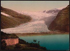
Svartisen from seaside
-
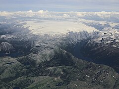
Aerial view
-
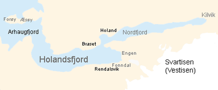
Holandsfjord where the glacier get closer to the sea than any other glacier in Europe (apart from Svalbard).
-
Aerial view
-
Glacier heading towards the water
-
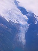
Engabreen seen from the air
-
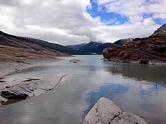
Body of water next to the glacier
See also
References
- ^ a b c d e Thorsnæs, Geir; Liestøl, Olav, eds. (2016-04-27). "Svartisen". Store norske leksikon (in Norwegian). Kunnskapsforlaget. Retrieved 2019-01-27.


