Palakot: Difference between revisions
Appearance
Content deleted Content added
No edit summary Tags: Mobile edit Mobile web edit |
No edit summary |
||
| Line 4: | Line 4: | ||
|official_name = Pala |
|official_name = Pala |
||
|other_name = |
|other_name = |
||
|native_name = पाला |
|native_name = पाला गाविस |
||
|nickname = |
|nickname = |
||
|settlement_type = [[Village development committee (Nepal)|Village development committee]] |
|settlement_type = [[Village development committee (Nepal)|Village development committee]] |
||
Revision as of 19:05, 7 February 2019
Pala
पाला गाविस | |
|---|---|
| Coordinates: 28°17′N 83°33′E / 28.28°N 83.55°E | |
| Country | |
| Zone | Dhaulagiri Zone |
| District | Baglung District |
| Population | |
| • Religions | Hindu |
| Time zone | UTC+5:45 (Nepal Time) |
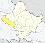
Palakot is a village development committee in Baglung District in the Dhaulagiri Zone of central Nepal.[1]
References
- ^ "Nepal Census 2001". Nepal's Village Development Committees. Digital Himalaya. Retrieved 2008-08-23.


