Pala: Difference between revisions
Appearance
Content deleted Content added
No edit summary Tags: disambiguation template removed External link added to disambiguation page |
|||
| Line 1: | Line 1: | ||
{{Infobox settlement |
|||
'''Pala''' may refer to: |
|||
<!--See the table at Infobox settlement for all fields and descriptions of usage--> |
|||
{{TOC right}} |
|||
<!-- Basic info --> |
|||
|official_name = Pala |
|||
|other_name = |
|||
|native_name = पाला गाविस |
|||
|nickname = |
|||
|settlement_type = [[Village development committee (Nepal)|Village development committee]] |
|||
|motto = |
|||
<!-- images and maps --> |
|||
|image_skyline = |
|||
|image_caption = |
|||
|image_flag = |
|||
|image_seal = |
|||
|image_map = |
|||
|mapsize = |
|||
|map_caption = |
|||
|pushpin_map = Nepal |
|||
|pushpin_label_position = bottom |
|||
|pushpin_mapsize = 300 |
|||
|pushpin_map_caption = Location in Nepal |
|||
<!-- Location --> |
|||
|subdivision_type = Country |
|||
|subdivision_name = {{flag|Nepal}} |
|||
|subdivision_type1 = [[Zones of Nepal|Zone]] |
|||
|subdivision_name1 = [[Dhawalagiri Zone|Dhaulagiri Zone]] |
|||
|subdivision_type2 = [[Districts of Nepal|District]] |
|||
|subdivision_name2 = [[Baglung District]] |
|||
<!-- Politics --> |
|||
|government_footnotes = |
|||
|government_type = |
|||
|leader_title = |
|||
|leader_name = |
|||
|leader_title1 = <!-- for places with, say, both a mayor and a city manager --> |
|||
|leader_name1 = |
|||
|established_title = <!-- Settled --> |
|||
|established_date = |
|||
<!-- Area --> |
|||
|unit_pref = <!--Enter: Imperial, if Imperial (metric) is desired--> |
|||
|area_footnotes = |
|||
|area_total_km2 = <!-- ALL fields dealing with a measurements are subject to automatic unit conversion--> |
|||
|area_total_sq_mi = |
|||
<!-- Population --> |
|||
|population_as_of = |
|||
|population_footnotes = |
|||
|population_note = |
|||
|population_total = |
|||
|population_density_km2 = auto |
|||
|population_blank1_title = Ethnicities |
|||
|population_blank2_title = Religions |
|||
|population_blank2 =[[Hindu]] |
|||
<!-- General information --> |
|||
|timezone = [[Nepal Time]] |
|||
|utc_offset = +5:45 |
|||
|timezone_DST = |
|||
|utc_offset_DST = |
|||
|coordinates = {{coord|28.28|83.55|type:adm2nd_region:NP_source:unmaps-enwiki|display=inline,title}} |
|||
|elevation_footnotes = <!--for references: use <ref> </ref> tags--> |
|||
|elevation_m = |
|||
<!-- Area/postal codes & others --> |
|||
|postal_code_type = <!-- enter ZIP code, Postcode, Post code, Postal code... --> |
|||
|postal_code = |
|||
|area_code = |
|||
|blank_name = |
|||
|blank_info = |
|||
|website = |
|||
|footnotes = |
|||
}} |
|||
'''Palakot''' is a [[Village development committee (Nepal)|village development committee]] in [[Baglung District]] in the [[Dhawalagiri Zone|Dhaulagiri Zone]] of central [[Nepal]].<ref>{{Cite web| url=http://www.digitalhimalaya.com/collections/nepalcensus/form.php?selection=1|title=Nepal Census 2001|work=Nepal's Village Development Committees|publisher=[[Digital Himalaya]]|accessdate=2008-08-23}}</ref> |
|||
== |
==References== |
||
<references /> |
|||
{{Baglung District}} |
|||
===Chad=== |
|||
*[[Pala, Chad]], the capital of the region of Mayo-Kebbi Ouest |
|||
===Estonia=== |
|||
*[[Pala Parish]], a rural municipality in Jõgeva County |
|||
*[[Pala, Kõue Parish]], a village in Kõue Parish, Harju County |
|||
*[[Pala, Kuusalu Parish]], a village in Kuusalu Parish, Harju County |
|||
*[[Pala, Järva County]], a village in Türi Parish, Järva County |
|||
[[Category:Populated places in Baglung District]] |
|||
===India=== |
|||
*[[Pala, Kerala]], a town in the state of Kerala |
|||
*[[Pala dynasty (disambiguation)]], several historical ruling groups |
|||
*[[Pala Empire]], an imperial power originating in Bengal during the Late Classical period |
|||
*Pala Lake, English name for [[Palak Dil]], a large lake in the state of Mizoram, Northeast India |
|||
===Turkey=== |
|||
*[[Palā]] or Pala: a Bronze Age country in northern Anatolia, |
|||
** where the extinct [[Palaic language]] (or ''Palaumnili''), a part of the Indo-European language family, was spoken. |
|||
{{Dhawalagiri-geo-stub}} |
|||
===United States=== |
|||
*[[Pala, California]], a small community in the Pala Indian Reservation within San Diego County |
|||
*[[Pala Casino Resort and Spa]], a casino located in Pala, California |
|||
===Fiction=== |
|||
* Pala, a fictional island in Aldous Huxley's [[Island (Huxley novel)|''Island'' (Huxley novel)]] |
|||
* Pala, a fictional town in ''[[Far Cry 2]]'', a video game |
|||
==Persons== |
|||
Pala "Mantrousse" Gilroy Sen, is a British caster, host, interviewer and online content creator. |
|||
==Other == |
|||
* [[Pala (album)]], the second album from Friendly Fires, released in 2011. |
|||
* [[Pala (surname)]], a list of people with the surname ''Pala'' |
|||
* [[Pala (sword)]], a short kind of Turkish sword or [[kilij]] |
|||
* [[Pala Empire]], an empire and dynasty on the Indian subcontinent, founded in 750 |
|||
* [[Pala Hamburger]], a Chinese fast-food chain |
|||
* [[Pala (dance)]], a folk-theatre form, native to the Indian state Odisha, akin to [[jatra (Bengal)]] |
|||
* PALA or ''Partido Laborista Agrario'', the [[Labor and Agrarian Party]] of Panama |
|||
* PALA, the [[Poetics and Linguistics Association]], an international academic association that supports studies of linguistic and literary styles |
|||
* PALA, Presidential Active Lifestyle Award, one of the awards given as part of [[the President's Challenge]] in the United States |
|||
==See also== |
|||
* [[Palas (disambiguation)]] |
|||
{{disambiguation}} |
|||
Revision as of 19:09, 7 February 2019
Pala
पाला गाविस | |
|---|---|
| Coordinates: 28°17′N 83°33′E / 28.28°N 83.55°E | |
| Country | |
| Zone | Dhaulagiri Zone |
| District | Baglung District |
| Population | |
| • Religions | Hindu |
| Time zone | UTC+5:45 (Nepal Time) |
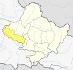
Palakot is a village development committee in Baglung District in the Dhaulagiri Zone of central Nepal.[1]
References
- ^ "Nepal Census 2001". Nepal's Village Development Committees. Digital Himalaya. Retrieved 2008-08-23.


