Lamadaya: Difference between revisions
Appearance
Content deleted Content added
No edit summary |
No edit summary |
||
| Line 5: | Line 5: | ||
| photo_caption = Lamadaya water falls in [[Sanaag]], [[Somalia]]. |
| photo_caption = Lamadaya water falls in [[Sanaag]], [[Somalia]]. |
||
| elevation = {{convert|2,410|m|ft|0}}<ref>[https://www.strategypage.com/articles/operationenduringfreedom/chap4.asp Somalia Country Study] {{webarchive|url=https://web.archive.org/web/20140811171823/http://strategypage.com/articles/operationenduringfreedom/chap4.asp |date=2014-08-11 }}</ref> |
| elevation = {{convert|2,410|m|ft|0}}<ref>[https://www.strategypage.com/articles/operationenduringfreedom/chap4.asp Somalia Country Study] {{webarchive|url=https://web.archive.org/web/20140811171823/http://strategypage.com/articles/operationenduringfreedom/chap4.asp |date=2014-08-11 }}</ref> |
||
| map = |
| map = Somaliland |
||
| map_caption = |
| map_caption = |
||
| location = [[Somaliland]] |
| location = [[Somaliland]] |
||
Revision as of 18:57, 17 February 2019
| Lamadaya | |
|---|---|
| لمداي | |
 | |
 | |
| Location | Somaliland |
| Coordinates | 10°44′09″N 47°14′42″E / 10.73583°N 47.24500°E |
| Elevation | 2,410 metres (7,907 ft)[1] |
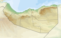
Lamadaya are waterfalls located in the Cal Madow mountain range in the northern Sanaag region of Somalia. The meaning of the word in the Afro-Asiatic Somali language is "not to be looked at", owing to the waterfalls' steep incline atop a high hill. The nearest town to Lamadaya is Ulheed, which is situated towards the Red Sea coast.
Gallery
Images of the Lamadaya waterfalls in Cal Madow.
-
Lamadaya waterfalls
-
Lamadaya waterfalls
-
Lamadaya waterfalls
-
Lamadaya waterfalls
-
Lamadaya waterfalls
-
Lamadaya waterfalls
Notes
- ^ Somalia Country Study Archived 2014-08-11 at the Wayback Machine


