Ain Bni Mathar: Difference between revisions
Appearance
Content deleted Content added
JJMC89 bot (talk | contribs) Remove unrecognized coordinate parameters. Use |coordinates={{coord|...}} instead. See Wikipedia:Coordinates in infoboxes. |
No edit summary |
||
| Line 68: | Line 68: | ||
|footnotes = |
|footnotes = |
||
}} |
}} |
||
'''Ain Bni Mathar''' is a town and municipality in [[Jerada Province]], [[Oriental (Morocco)| |
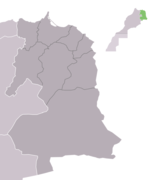
'''Ain Bni Mathar''' ([[Berber language|Berber]]: '''Tiṭ En Ayt Meṭher''') is a town and municipality in [[Jerada Province]], [[Oriental (Morocco)|Eastern region]], [[Morocco]]. It is located 81 km south of [[Oujda|Wejda]] and 36 km from the Algerian border. |
||
According to the 2004 census it has a population of 13,526.<ref>{{cite web|url=http://www.world-gazetteer.com/wg.php?x=1265320135&men=gcis&lng=en&des=wg&geo=-6468&srt=npan&col=adhoq&msz=1500|title=World Gazetteer}}</ref> |
According to the 2004 census it has a population of 13,526.<ref>{{cite web|url=http://www.world-gazetteer.com/wg.php?x=1265320135&men=gcis&lng=en&des=wg&geo=-6468&srt=npan&col=adhoq&msz=1500|title=World Gazetteer}}</ref> |
||
Revision as of 12:58, 27 February 2019
Ain Bni Mathar | |
|---|---|
Town | |
 | |
| Country | |
| Region | Oriental |
| Province | Jerada |
| Population (2014) | |
• Total | 16,289 |
| Time zone | UTC+0 (WET) |
| • Summer (DST) | UTC+1 (WEST) |
Ain Bni Mathar (Berber: Tiṭ En Ayt Meṭher) is a town and municipality in Jerada Province, Eastern region, Morocco. It is located 81 km south of Wejda and 36 km from the Algerian border.
According to the 2004 census it has a population of 13,526.[1]
In 2011 the first Thermo Solar Combined Cycle Power Plant of Morocco has been created near the town.
References
34°05′20″N 2°01′29″W / 34.08889°N 2.02472°W

