Kailali District: Difference between revisions
No edit summary |
No edit summary |
||
| Line 20: | Line 20: | ||
| website = {{URL|www.facebook.com/kailali}} |
| website = {{URL|www.facebook.com/kailali}} |
||
}} |
}} |
||
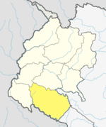
'''Kailali District''' ({{lang-ne|[[:ne:कैलाली जिल्ला|कैलाली जिल्ला]]}}{{Audio|Kailali.ogg|Listen}}), a part of [[Province No. 7]] in [[Terai]] plain, is one of the 77 [[Districts of Nepal|districts]] of [[Nepal]]. The district, with [[Dhangadhi]] as its district headquarters, covers an area of {{Convert|3235|km2|mi2}} and has a population (2011 census) of 775,709 (616,697 on 2001 census). |
'''Kailali District''' ({{lang-ne|[[:ne:कैलाली जिल्ला|कैलाली जिल्ला]]}}{{Audio|Kailali.ogg|Listen}}), a part of [[Province No. 7]] in [[Terai]] plain, is one of the 77 [[Districts of Nepal|districts]] of [[Nepal]]. The district, with [[Dhangadhi]] as its district headquarters, covers an area of {{Convert|3235|km2|mi2}} and has a population (2011 census) of 775,709 (616,697 on 2001 census). It is surrounded by [[Mahendranagar]] District in the west , [[Bardiya District]] in the east , [[Doti District]] in the north and [[Uttar Pradesh]] in the south . |
||
[[File:Tikapurpark.jpg|thumb|right|Tikapur Park]] |
|||
| ⚫ | Dhangadhi, a sub-metro city, is a center of attraction of not only Kailali district but of the whole Seti zone. The district also contains Tikapur Park, one of the biggest parks in Nepal, and Godha-Ghodi Tal (lake) located at Sukhad Kailali , [[Karnali Bridge]] at [[Lamki Chuha Municipality]]. An aircraft museum was established in [[Dhangadhi ]] by Pilot Bed Upreti in 2014, which is the only museum of its kind in the country.{{citation needed|date=September 2018}} |
||
[[File:Aircraft museum.jpg|thumb|right|aircraft museum]] |
|||
| ⚫ | Dhangadhi, a sub-metro city, is a center of attraction of not only Kailali district but of the whole Seti zone. The district also contains Tikapur Park, one of the biggest parks in Nepal, and Godha-Ghodi Tal (lake) located at Sukhad Kailali. An aircraft museum was established in Dhangadhi by Pilot Bed Upreti in 2014, which is the only museum of its kind in the country.{{citation needed|date=September 2018}} |
||
==Geography and climate== |
==Geography and climate== |
||
Revision as of 07:30, 9 March 2019
This article needs additional citations for verification. (September 2014) |
Template:Infobox Nepal district Kailali District (Template:Lang-neⓘ), a part of Province No. 7 in Terai plain, is one of the 77 districts of Nepal. The district, with Dhangadhi as its district headquarters, covers an area of 3,235 square kilometres (1,249 sq mi) and has a population (2011 census) of 775,709 (616,697 on 2001 census). It is surrounded by Mahendranagar District in the west , Bardiya District in the east , Doti District in the north and Uttar Pradesh in the south .
Dhangadhi, a sub-metro city, is a center of attraction of not only Kailali district but of the whole Seti zone. The district also contains Tikapur Park, one of the biggest parks in Nepal, and Godha-Ghodi Tal (lake) located at Sukhad Kailali , Karnali Bridge at Lamki Chuha Municipality. An aircraft museum was established in Dhangadhi by Pilot Bed Upreti in 2014, which is the only museum of its kind in the country.[citation needed]
Geography and climate
| Climate zone[1] | Elevation range | % of area |
|---|---|---|
| Lower Tropical | below 300 meters (1,000 ft) | 59.3% |
| Upper Tropical | 300 to 1,000 meters 1,000 to 3,300 ft. |
25.9% |
| Subtropical | 1,000 to 2,000 meters 3,300 to 6,600 ft. |
13.8% |
Administration
The district consists of 13 municipalities, of which one is a sub-metropolitan city, six are urban municipalities and six are rural municipalities. These are as follows:[2]
- Dhangadhi Sub-Metropolitan City
- Tikapur Municipality
- Ghodaghodi Municipality
- Lamki Chuha Municipality
- Bhajani Municipality
- Godawari Municipality
- Gauriganga Municipality
- Janaki Rural Municipality
- Bardgoriya Rural Municipality
- Mohanyal Rural Municipality
- Kailari Rural Municipality
- Joshipur Rural Municipality
- Chure Rural Municipality
Former village development committees

Prior to the restructuring of the district, Kailali District consisted of the following village development committees:
- Basauti
- Bauniya
- Chaumala
- Dansinhapur
- Dododhara
- Durgauli
- Darakha
- Gadariya
- Hasuliya
- Janakinagar
- Joshipur
- Khairala
- Kota Tulsipur
- Masuriya
- Mohanyal
- Munuwa
- Nigali
- Pahalmanpur
- Pandaun
- Pawera
- Pratappur
- Ratnapur
- Sahajpur
- Sugarkhal
- Thapapur
- Udasipur
- Narayanpur
See also
References
- ^ The Map of Potential Vegetation of Nepal - a forestry/agroecological/biodiversity classification system (PDF), . Forest & Landscape Development and Environment Series 2-2005 and CFC-TIS Document Series No.110., 2005, ISBN 87-7903-210-9, retrieved Nov 22, 2013
- ^ "स्थानिय तह" (in Nepali). Ministry of Federal Affairs and General Administration. Retrieved 1 September 2018.
External links
- "Districts of Nepal". Statoids.

