Uaxactun Airport: Difference between revisions
Appearance
Content deleted Content added
Ledublinois (talk | contribs) No edit summary |
update infobox, misc formatting, add category |
||
| Line 12: | Line 12: | ||
| IATA = UAX |
| IATA = UAX |
||
| ICAO = |
| ICAO = |
||
| FAA = |
|||
| TC = |
|||
| LID = |
|||
| GPS = |
|||
| WMO = |
|||
| type = |
| type = |
||
| owner-oper = |
| owner-oper = |
||
| owner = |
| owner = |
||
| operator = |
| operator = |
||
| city-served = [[Uaxactun]], |
| city-served = [[Uaxactun]], Guatemala |
||
| location = |
| location = <!-- if different --> |
||
| hub = |
| hub = |
||
| built = <!-- military airports --> |
| built = <!-- military airports --> |
||
| Line 31: | Line 26: | ||
| elevation-f = 573 |
| elevation-f = 573 |
||
| elevation-m = |
| elevation-m = |
||
| coordinates = {{coord|17|23|35|N|89|38|05|W|region: |
| coordinates = {{coord|17|23|35|N|89|38|05|W|region:GT_type:airport|display=inline,title}} |
||
| website = |
| website = |
||
| image_map = |
| image_map = |
||
| Line 37: | Line 32: | ||
| image_map_alt = |
| image_map_alt = |
||
| image_map_caption = |
| image_map_caption = |
||
| pushpin_map = Guatemala |
| pushpin_map = Guatemala Petén#Guatemala |
||
| ⚫ | |||
| pushpin_label_position = |
| pushpin_label_position = |
||
| pushpin_label = '''UAX''' |
| pushpin_label = '''UAX''' |
||
| pushpin_map_alt = |
| pushpin_map_alt = |
||
| ⚫ | |||
| metric-rwy = y |
| metric-rwy = y |
||
| r1-number = 04/22 |
| r1-number = 04/22 |
||
| Line 53: | Line 48: | ||
}} |
}} |
||
'''Uaxactun Airport''' {{airport codes |
'''Uaxactun Airport''' {{airport codes|UAX}} is an [[airstrip]] in the village of [[Uaxactun]], [[Guatemala]]. |
||
The airstrip may be closed. Aerial imagery (Google Earth 3/27/2014) shows less than {{convert|300|m}} of grass landing area remaining unobstructed by trees and structures.<ref>{{cite web |title=Uaxactun runway |url=https://wego.here.com/?map=17.39373,-89.63355,19,satellite |website=HERE Maps |publisher=Here |accessdate=13 August 2018}}</ref><ref>{{cite web |title=Uaxactun airstrip |url=https://www.google.com/maps/@17.3933834,-89.6343841,300m/data=!3m1!1e3 |website=Google Maps |publisher=Google |accessdate=13 August 2018}}</ref> |
The airstrip may be closed. Aerial imagery (Google Earth 3/27/2014) shows less than {{convert|300|m}} of grass landing area remaining unobstructed by trees and structures.<ref>{{cite web |title=Uaxactun runway |url=https://wego.here.com/?map=17.39373,-89.63355,19,satellite |website=HERE Maps |publisher=Here |accessdate=13 August 2018}}</ref><ref>{{cite web |title=Uaxactun airstrip |url=https://www.google.com/maps/@17.3933834,-89.6343841,300m/data=!3m1!1e3 |website=Google Maps |publisher=Google |accessdate=13 August 2018}}</ref> |
||
| Line 60: | Line 55: | ||
==See also== |
==See also== |
||
*{{portal-inline|Guatemala}} |
* {{portal-inline|Guatemala}} |
||
*{{portal-inline|Aviation}} |
* {{portal-inline|Aviation}} |
||
*[[Transport in Guatemala]] |
* [[Transport in Guatemala]] |
||
*[[List of airports in Guatemala]] |
* [[List of airports in Guatemala]] |
||
==References== |
==References== |
||
{{Reflist}} |
{{Reflist}} |
||
{{Airports in Guatemala |
{{Airports in Guatemala}} |
||
[[Category:Airports in Guatemala]] |
[[Category:Airports in Guatemala]] |
||
[[Category:Petén Department]] |
|||
Revision as of 00:49, 14 March 2019
Uaxactun Airport | |||||||||||
|---|---|---|---|---|---|---|---|---|---|---|---|
| Summary | |||||||||||
| Serves | Uaxactun, Guatemala | ||||||||||
| Elevation AMSL | 573 ft / 175 m | ||||||||||
| Coordinates | 17°23′35″N 89°38′05″W / 17.39306°N 89.63472°W | ||||||||||
| Map | |||||||||||
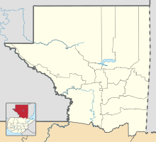
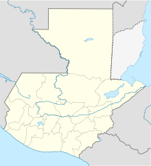
Location in Petén Department Location in Guatemala | |||||||||||
 | |||||||||||
| Runways | |||||||||||
| |||||||||||
Uaxactun Airport (IATA: UAX) is an airstrip in the village of Uaxactun, Guatemala.
The airstrip may be closed. Aerial imagery (Google Earth 3/27/2014) shows less than 300 metres (980 ft) of grass landing area remaining unobstructed by trees and structures.[3][4]
The Tikal VOR-DME (Ident: TIK) is located 31.8 nautical miles (58.9 km) south-southwest of Uaxactun.[5]
See also
References
- ^ OurAirports - Uaxactun
- ^ Accident history for Uaxactun Airport at Aviation Safety Network
- ^ "Uaxactun runway". HERE Maps. Here. Retrieved 13 August 2018.
- ^ "Uaxactun airstrip". Google Maps. Google. Retrieved 13 August 2018.
- ^ Tikal VOR


