Sanghe Khalsa: Difference between revisions
Appearance
Content deleted Content added
Tags: categories removed Mobile edit Mobile web edit |
reverted 3 edits by Shubhdeep sangha; spam |
||
| Line 39: | Line 39: | ||
| population_as_of = |
| population_as_of = |
||
| population_rank = |
| population_rank = |
||
| population_density_km2 = |
| population_density_km2 = auto |
||
| population_demonym = |
| population_demonym = |
||
| population_footnotes = |
| population_footnotes = |
||
| demographics_type1 = Languages |
| demographics_type1 = Languages |
||
| demographics1_title1 = |
| demographics1_title1 = Official |
||
| demographics1_info1 = [[Gurmukhi|Punjabi]] |
| demographics1_info1 = [[Gurmukhi|Punjabi]] |
||
| demographics1_title2 = Regional |
| demographics1_title2 = Regional |
||
| Line 52: | Line 52: | ||
| postal_code = 144044 |
| postal_code = 144044 |
||
| area_code_type = Telephone code |
| area_code_type = Telephone code |
||
| area_code = |
| area_code = 01821 |
||
| registration_plate = [[List of RTO districts in India#PB.E2.80.94Punjab|PB]]- 08 |
| registration_plate = [[List of RTO districts in India#PB.E2.80.94Punjab|PB]]- 08 |
||
| blank1_name_sec1 = Nearest city |
| blank1_name_sec1 = Nearest city |
||
| blank1_info_sec1 = [[Nurmahal]] |
| blank1_info_sec1 = [[Nurmahal]] |
||
| website = |
| website = |
||
| footnotes = |
| footnotes = |
||
}} |
}} |
||
| Line 62: | Line 62: | ||
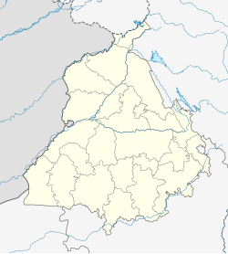
'''Sanghe Khalsa''' is a small village in [[Nurmahal]]. Nurmahal is a sub-tehsil in the city [[Jalandhar]] of Indian state of [[Punjab (India)|Punjab]]. |
'''Sanghe Khalsa''' is a small village in [[Nurmahal]]. Nurmahal is a sub-tehsil in the city [[Jalandhar]] of Indian state of [[Punjab (India)|Punjab]]. |
||
== STD code == |
== STD code == |
||
Sanghe Khalsa' |
Sanghe Khalsa's STD code is 01826 |
||
==References== |
==References== |
||
{{reflist}} |
|||
About six kilometer away from Noormahal, which enjoy special place during mughal reign is located a beautiful village Sanghe Khalsa. One Kilometer away from Sher-Shah Suri Marg, from Nurmahal to Nakodar road, one canal passes through this village and a railway line passes hereby which connects Phillaur to Ferozepur. From different side three concrete roads enter in this village. |
|||
The foundation of village sanghe Khalsa is laid by Chaudhary Daya Chand in 1704 Bikrami Samat and in English in 1647, Daya Chand Ji was from Surname Sanghe and they settled here from Khalsa Sanghe or Harimpur. It is 52 years before the establishment of Khalsa by Guru Gobind Singh. Then this village was known as Sanghe of Daya. |
|||
[[Category:Villages in Jalandhar district]] |
|||
{{PunjabIN-geo-stub}} |
|||
Revision as of 15:04, 31 March 2019
Sanghe Khalsa | |
|---|---|
village | |
| Coordinates: 31°06′00″N 75°32′32″E / 31.100001°N 75.542250°E | |
| Country | |
| State | Punjab |
| District | Jalandhar |
| Talukas | Nurmahal |
| Languages | |
| • Official | Punjabi |
| • Regional | Punjabi |
| Time zone | UTC+5:30 (IST) |
| PIN | 144044 |
| Telephone code | 01821 |
| Vehicle registration | PB- 08 |
| Nearest city | Nurmahal |
Sanghe Khalsa is a small village in Nurmahal. Nurmahal is a sub-tehsil in the city Jalandhar of Indian state of Punjab.
STD code
Sanghe Khalsa's STD code is 01826
References


