Markook mandal: Difference between revisions
Appearance
Content deleted Content added
m en-IN |
No edit summary Tags: Visual edit Mobile edit Mobile web edit |
||
| Line 2: | Line 2: | ||
{{Use Indian English|date=August 2018}} |
{{Use Indian English|date=August 2018}} |
||
{{Infobox settlement |
{{Infobox settlement |
||
| name = Markook |
| name = Markook, Hyderabad |
||
| native_name = |
| native_name = |
||
| native_name_lang = te |
| native_name_lang = te |
||
| Line 22: | Line 22: | ||
| subdivision_name2 = [[siddipet district|siddipet]] |
| subdivision_name2 = [[siddipet district|siddipet]] |
||
| established_title = <!-- Established --> |
| established_title = <!-- Established --> |
||
| established_date = |
| established_date = |
||
| founder = |
| founder = |
||
| named_for = |
| named_for = |
||
| government_type = [[Maps| |
| government_type = [[Maps|Hyderabad Metropolitan Development Authority (HMDA)]] |
||
| governing_body = |
| governing_body = Gajwel (Assembly constituency) |
||
| unit_pref = Metric |
| unit_pref = Metric |
||
| area_footnotes = |
| area_footnotes = |
||
| area_rank = |
| area_rank = |
||
| area_total_km2 = |
| area_total_km2 = |
||
| elevation_footnotes = |
| elevation_footnotes = |
||
| elevation_m = |
| elevation_m = |
||
| population_total = |
| population_total = |
||
| population_as_of = |
| population_as_of = |
||
| population_rank = |
| population_rank = |
||
| population_density_km2 = auto |
| population_density_km2 = auto |
||
| population_demonym = |
| population_demonym = |
||
| population_footnotes = |
| population_footnotes = |
||
| demographics_type1 = Languages |
| demographics_type1 = Languages |
||
| demographics1_title1 = Official |
| demographics1_title1 = Official |
||
| demographics1_info1 = [[Telugu language|Telugu]] |
| demographics1_info1 = [[Telugu language|Telugu]] |
||
| timezone1 = [[Indian Standard Time|IST]] |
| timezone1 = [[Indian Standard Time|IST]] |
||
| utc_offset1 = +5:30 |
| utc_offset1 = +5:30 |
||
| postal_code_type = [[Postal Index Number|PIN]] |
| postal_code_type = [[Postal Index Number|PIN]] |
||
| postal_code = 502279 |
| postal_code = 502279 |
||
| registration_plate = TS 36 |
| registration_plate = TS 36 |
||
| blank1_name_sec1 = Nearest city |
| blank1_name_sec1 = Nearest city |
||
| blank1_info_sec1 = [[HYDERABAD]] |
| blank1_info_sec1 = [[HYDERABAD]] |
||
| website = {{URL|telangana.gov.in}} |
| website = {{URL|telangana.gov.in}} |
||
{{URL|http://tracgis.telangana.gov.in/hmda/}} |
|||
| footnotes = |
| footnotes = |
||
| official_name = |
|||
}} |
}} |
||
Revision as of 02:37, 27 April 2019
Markook, Hyderabad | |
|---|---|
| Coordinates: 17°45′08″N 78°43′15″E / 17.7521°N 78.7207°E | |
| Country | |
| State | Telangana |
| District | siddipet |
| Government | |
| • Type | Hyderabad Metropolitan Development Authority (HMDA) |
| • Body | Gajwel (Assembly constituency) |
| Languages | |
| • Official | Telugu |
| Time zone | UTC+5:30 (IST) |
| PIN | 502279 |
| Vehicle registration | TS 36 |
| Nearest city | HYDERABAD |
| Website | telangana |
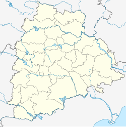
Markook is a Mandal in Siddipet district of Telangana State, India.[1]
Villages in Markook Mandal
- Karkapatla
- Damarakunta
- Pamulaparthi
- Angadi Kistapur
- Cheberthy
- Erravalli
- Narasannapet
- Sivar Venkatapur
- Bhavanandhapur
- Vardarajpur
- Pathur
Geography
Located at 17°45′08″N 78°43′15″E / 17.7521°N 78.7207°E, Markook has an average elevation of 595 metres (1,952 ft). Markook a major gram panchayath of Gajwel constituency and also its a part of the Hyderabad Metropolitan Development Authority.
Assembly constituency: Gajwel
Assembly MLA: Kalvakuntla Chandrashekar Rao
Lok Sabha constituency: Medak
Parliament MP: Kotha Prabhakar Reddy
References
- ^ "District Level Mandal wise list of villages in Siddipet district" (PDF). Chief Commissioner of Land Administration. National Informatics Centre. Archived from the original (PDF) on 2 April 2015. Retrieved 5 March 2016.


