Division of Curtin: Difference between revisions
No edit summary |
No edit summary |
||
| Line 105: | Line 105: | ||
| nowrap | [[Australian federal election, 1998|3 October 1998]] –<br/>May 2019 |
| nowrap | [[Australian federal election, 1998|3 October 1998]] –<br/>May 2019 |
||
| Deputy Liberal Leader 2007-18. Served as minister under [[Howard Government|Howard]], [[Abbott Government|Abbott]], [[Turnbull Government|Turnbull]] and [[Morrison Government|Morrison]]. Retired at the 2019 federal election. |
| Deputy Liberal Leader 2007-18. Served as minister under [[Howard Government|Howard]], [[Abbott Government|Abbott]], [[Turnbull Government|Turnbull]] and [[Morrison Government|Morrison]]. Retired at the 2019 federal election. |
||
|- |
|||
| {{Australian party style|Liberal}}| |
|||
| |
|||
| [[Celia Hammond (politician)|Celia Hammond]] |
|||
| [[Liberal Party of Australia|Liberal]] |
|||
| nowrap | [[Australian federal election, 2019|May 2019]] |
|||
| Incumbent |
|||
|} |
|} |
||
Revision as of 04:41, 23 May 2019
| Curtin Australian House of Representatives Division | |
|---|---|
 Division of Curtin in Western Australia, as of the 2016 federal election. | |
| Created | 1949 |
| MP | Celia Hammond |
| Party | Liberal |
| Namesake | John Curtin |
| Electors | 100,365 (2019) |
| Area | 98 km2 (37.8 sq mi) |
| Demographic | Inner Metropolitan |
The Division of Curtin is an Australian Electoral Division in Western Australia.
History

The division was created in 1949 and is named for John Curtin, who was Prime Minister of Australia from 1941 to 1945. Prior to its creation, much of this area was part of the Division of Fremantle, which Curtin represented for most of the time from 1928 to 1945. It is located in the wealthy beachside suburbs of Perth, including Claremont, Cottesloe, Mosman Park, Nedlands, Subiaco and Swanbourne.
It was created as a notional Labor seat. However, this area was located in naturally Liberal territory, and the Liberals won it resoundingly as part of their massive victory in the 1949 election, turning it into a safe Liberal seat in one stroke. It has been held comfortably by either a Liberal or a conservative independent since. The only time it was out of Liberal hands came when Allan Rocher won it in 1996 after losing his Liberal endorsement. Rocher was defeated at the 1998 election, when current member Julie Bishop reclaimed it for the Liberals.
Its most prominent member has been Paul Hasluck, who was a senior Cabinet minister in the Menzies and Holt governments and then Governor-General of Australia after leaving politics. Other prominent members include Victor Garland, a minister in the McMahon and Fraser governments, and Bishop, the former Deputy Leader of the Liberal Party (the first woman to hold this role) and a minister in the Howard, Abbott, and Turnbull governments. With a two-party preferred margin as of the 2016 election of 20.7%, it is currently the safest federal seat in Western Australia and the second-safest Coalition seat in metropolitan Australia.
Geography
Curtin covers an area west of Perth, bordered by the Indian Ocean in the west and the Swan River in the south. The suburbs include:[1]
- Churchlands
- City Beach
- Claremont
- Cottesloe
- Crawley
- Daglish
- Dalkeith
- Doubleview
- Floreat
- Glendalough
- Herdsman
- Innaloo
- Jolimont
- Karrakatta
- Karrinyup (part)
- Mount Claremont
- Mosman Park
- Osborne Park (part)
- Nedlands
- Peppermint Grove
- Scarborough (part)
- Shenton Park
- Swanbourne
- Subiaco
- West Leederville
- Wembley
- Wembley Downs
- Woodlands
Members
| Image | Member | Party | Term | Notes | |
|---|---|---|---|---|---|

|
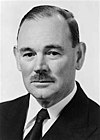
Paul Hasluck (1905–1993) |
Liberal | 10 December 1949 – 12 February 1969 |
Served as minister under Menzies, Holt, McEwen and Gorton. Resigned in order to become Governor-General of Australia | |

|
Victor Garland (1934–) |
Liberal | 19 April 1969 – 22 January 1981 |
Served as minister under McMahon and Fraser. Resigned in order to become the High Commissioner to the United Kingdom | |

|
Allan Rocher (1936–2016) |
Liberal | 21 February 1981 – 7 August 1995 |
Previously a member of the Senate. Lost seat | |
| Independent | 7 August 1995 – 3 October 1998 | ||||

|
Julie Bishop (1956–) |
Liberal | 3 October 1998 – May 2019 |
Deputy Liberal Leader 2007-18. Served as minister under Howard, Abbott, Turnbull and Morrison. Retired at the 2019 federal election. | |
| Celia Hammond | Liberal | May 2019 | Incumbent |
Election results
References
- ^ "Profile of the electoral division of Curtin (WA)". Australian Electoral Commission. Retrieved 24 April 2016.
