Arkalyk Airport: Difference between revisions
Appearance
Content deleted Content added
AYK hatnote. |
m remove links to deleted portals |
||
| Line 39: | Line 39: | ||
{{Reflist}} |
{{Reflist}} |
||
{{ |
{{Portal bar|Aviation}} |
||
{{Airports in Kazakhstan}} |
{{Airports in Kazakhstan}} |
||
{{Airports built in the Soviet Union}} |
{{Airports built in the Soviet Union}} |
||
Revision as of 02:50, 12 August 2019
Arkalyk | |||||||||||
|---|---|---|---|---|---|---|---|---|---|---|---|
 NASA staff wait on the apron at Arkalyk whilst a Russian helicopter is refuelled, in April 2008 | |||||||||||
| Summary | |||||||||||
| Airport type | Public | ||||||||||
| Location | Arkalyk | ||||||||||
| Elevation AMSL | 388 m / 1,273 ft | ||||||||||
| Coordinates | 50°19′30″N 066°57′36″E / 50.32500°N 66.96000°E | ||||||||||
| Map | |||||||||||
 | |||||||||||
| Runways | |||||||||||
| |||||||||||
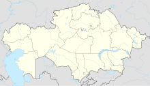
Arkalyk Airport[1] (also given as Arkalyk North) (IATA: AYK, ICAO: UAUR) is an airport in Kazakhstan[2] located 9 km (5.6 mi) north of Arkalyk. It is a small civilian airport built during the Soviet era, and has a sizeable asphalt apron and passenger terminal. The terminal building is in a state of disrepair, and may be completely disused, and the apron and runway are both poorly maintained. The facility is used by the Russian space agency to base and refuel helicopters used in the recovery of returning Soyuz missions. It may also see private use. At present there are no scheduled airlines serving the airport.
References
- ^ "Russian space capsule misses landing by 420 km". CTVNews. April 19, 2008. Retrieved September 6, 2015.
- ^ Berger, Eric (July 7, 2009). "NASA manager: Though a bit 'boring,' space station an essential stepping stone". Houston Chronicle. Retrieved September 6, 2015.

