Costa y Guillamón: Difference between revisions
Appearance
Content deleted Content added
Rescuing 1 sources and tagging 0 as dead. #IABot (v2.0beta15) |
m →Population: Task 16: replaced (2×) / removed (0×) deprecated |dead-url= and |deadurl= with |url-status=; |
||
| Line 36: | Line 36: | ||
==Population== |
==Population== |
||
In 2011 Costa y Guillamón had a population of 530.<ref>{{cite web |url=http://www.ine.gub.uy/censos2011/resultadosfinales/canelones.html |title=Censos 2011 Canelones (flash plugin needed) |year=2012 |publisher=INE |accessdate=25 August 2012 | |
In 2011 Costa y Guillamón had a population of 530.<ref>{{cite web |url=http://www.ine.gub.uy/censos2011/resultadosfinales/canelones.html |title=Censos 2011 Canelones (flash plugin needed) |year=2012 |publisher=INE |accessdate=25 August 2012 |url-status=dead |archiveurl=https://web.archive.org/web/20120907041709/http://www.ine.gub.uy/censos2011/resultadosfinales/canelones.html |archivedate=7 September 2012 }}</ref> |
||
{| class="wikitable" style="line-height:1.1em;" |
{| class="wikitable" style="line-height:1.1em;" |
||
! Year || Population |
! Year || Population |
||
| Line 52: | Line 52: | ||
| 2011 || 550 |
| 2011 || 550 |
||
|} |
|} |
||
Source: ''Instituto Nacional de Estadística de Uruguay''<ref>{{cite web|url=http://www.ine.gub.uy/biblioteca/toponimico/TOPOletraC.doc |title=1963–1996 Statistics / C |publisher=''Instituto Nacional de Estadística de Uruguay'' |year=2004 |format=DOC |accessdate=27 June 2011 | |
Source: ''Instituto Nacional de Estadística de Uruguay''<ref>{{cite web|url=http://www.ine.gub.uy/biblioteca/toponimico/TOPOletraC.doc |title=1963–1996 Statistics / C |publisher=''Instituto Nacional de Estadística de Uruguay'' |year=2004 |format=DOC |accessdate=27 June 2011 |url-status=dead |archiveurl=https://web.archive.org/web/20110721211855/http://www.ine.gub.uy/biblioteca/toponimico/TOPOletraC.doc |archivedate=21 July 2011 }}</ref> |
||
==References== |
==References== |
||
Revision as of 13:11, 27 September 2019
Costa y Guillamón | |
|---|---|
Barrio of La Paz | |
| Coordinates: 34°45′37″S 56°14′18″W / 34.76028°S 56.23833°W | |
| Country | |
| Department | Canelones Department |
| Population (2011) | |
• Total | 550 |
| Time zone | UTC -3 |
| Postal code | 90100 |
| Dial plan | +598 2 (+7 digits) |
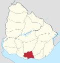
Costa y Guillamón is a barrio of La Paz in the Canelones Department of southern Uruguay.
Location
It is located at the west side of the city, on the south edge of the lake Canteras de La Paz.
Population
In 2011 Costa y Guillamón had a population of 530.[1]
| Year | Population |
|---|---|
| 1963 | 272 |
| 1975 | 549 |
| 1985 | 481 |
| 1996 | 562 |
| 2004 | 566 |
| 2011 | 550 |
Source: Instituto Nacional de Estadística de Uruguay[2]
References
- ^ "Censos 2011 Canelones (flash plugin needed)". INE. 2012. Archived from the original on 7 September 2012. Retrieved 25 August 2012.
- ^ "1963–1996 Statistics / C". Instituto Nacional de Estadística de Uruguay. 2004. Archived from the original (DOC) on 21 July 2011. Retrieved 27 June 2011.
{{cite web}}: Italic or bold markup not allowed in:|publisher=(help)
External links


