Sool: Difference between revisions
Yamaguchi先生 (talk | contribs) Reverted good faith edits by Jabane-10 (talk): Unsourced change. |
It is currently controlled by Somaliland but Somaliland is internationally recognised as part of Somalia. Tags: Mobile edit Mobile web edit |
||
| Line 23: | Line 23: | ||
| seat_type = Capital |
| seat_type = Capital |
||
| seat = [[Las Anod]] |
| seat = [[Las Anod]] |
||
| government_type = {{flag| |
| government_type = {{flag|Somaliland}} |
||
| leader_title = |
| leader_title = |
||
| leader_name = |
| leader_name = |
||
Revision as of 17:55, 6 November 2019
Sool | |
|---|---|
 | |
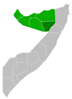
 Location in Somalia. | |
| Country | |
| Capital | Las Anod |
| Government | |
| • Type | |
| Population (2014) | |
• Total | 327,428 [1] |
| Time zone | UTC+3 (EAT) |
| HDI (2017) | 0.327[2] low · 8th |
Sool (Template:Lang-so, Template:Lang-ar) is an administrative region in Somalia.
History
With its capital at Las Anod, Sool was historically the seat of the anti-colonial Dervish (Darwiish) movement.
Demographics
The region is mainly inhabited by people from the Somali ethnic group, with the Dhulbahante subdivision of the Harti Darod, Habar Jeclo and Habar Yoonis sub-clans of Isaaq well-represented.[3]
Districts
The Sool region consists of 4 districts.[4]
Territorial dispute
Under the government of Siad Barre, Sool was not a separate region but part of the larger Nugaal province, with its capital at Garowe. It was separated from Nugaal in the 1980s, with its new capital at Lasanod.[5] From 2003 until October 2007, Sool was administered by Puntland, a territory with a similar clan composition.[6] In 2007, forces from Somaliland assumed control of the region.
In the late 2000s, HBM-SSC (Hoggaanka Badbaadada iyo Mideynta SSC), a local unionist opposition group whose goal is to establish its own regional administration (Sool, Sanaag and Cayn or SSC), was formed.[6] The group engaged with talks with the government of Somaliland which resulted in their participation in the political process, and as a result of the negotiations SSC has been included in the current government of Somaliland [7]
See also
References
- ^ [1]
- ^ "Sub-national HDI - Area Database - Global Data Lab". hdi.globaldatalab.org. Retrieved 13 September 2018.
- ^ "Somalia Security Situation" (PDF).
- ^ "Sool Region" (PDF). Retrieved 30 December 2013.
- ^ "Somalia (1988)". CIA. December 1988. Retrieved 21 February 2007.
- ^ a b Somaliland’s Quest for International Recognition and the HBM-SSC Factor
- ^ "Somaliland.org". Retrieved 26 February 2017.
External links
8°23′46″N 47°41′29″E / 8.39611°N 47.69139°E
