Châtel-Censoir: Difference between revisions
Appearance
Content deleted Content added
ibx img |
m →References: add authority control |
||
| Line 31: | Line 31: | ||
{{reflist}} |
{{reflist}} |
||
{{commons category}} |
|||
{{commonscat}} |
|||
{{Yonne communes}} |
{{Yonne communes}} |
||
{{authority control}} |
|||
{{DEFAULTSORT:Chatelcensoir}} |
{{DEFAULTSORT:Chatelcensoir}} |
||
Revision as of 01:33, 12 January 2020
Châtel-Censoir | |
|---|---|
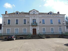
 The town hall in Châtel-Censoir | |
| Coordinates: 47°31′57″N 3°38′05″E / 47.53250°N 3.6347°E | |
| Country | France |
| Region | Bourgogne-Franche-Comté |
| Department | Yonne |
| Arrondissement | Avallon |
| Canton | Joux-la-Ville |
Area 1 | 24.62 km2 (9.51 sq mi) |
| Population (2021)[1] | 566 |
| • Density | 23/km2 (60/sq mi) |
| Time zone | UTC+01:00 (CET) |
| • Summer (DST) | UTC+02:00 (CEST) |
| INSEE/Postal code | 89091 /89660 |
| Elevation | 127–283 m (417–928 ft) |
| 1 French Land Register data, which excludes lakes, ponds, glaciers > 1 km2 (0.386 sq mi or 247 acres) and river estuaries. | |
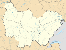
Châtel-Censoir is a commune in the Yonne department in Bourgogne-Franche-Comté in north-central France.
See also
References
- ^ "Populations légales 2021" (in French). The National Institute of Statistics and Economic Studies. 28 December 2023.
Wikimedia Commons has media related to Châtel-Censoir.


