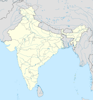
Rajpur Sonarpur: Difference between revisions
Reverted to revision 940787489 by Fylindfotberserk (talk): Wikipedia is not a travel guide. See WP:NOTTRAVEL (TW) |
No edit summary Tags: Mobile edit Mobile web edit Advanced mobile edit |
||
| Line 6: | Line 6: | ||
| native_name_lang = |
| native_name_lang = |
||
| other_name = |
| other_name = |
||
| settlement_type = |
| settlement_type = Neighborhood in Kolkata (Calcutta) |
||
| image_skyline = South winds rajpur.jpg |
| image_skyline = South winds rajpur.jpg |
||
| image_alt = |
| image_alt = |
||
Revision as of 13:48, 10 March 2020
Rajpur Sonarpur | |
|---|---|
Neighborhood in Kolkata (Calcutta) | |
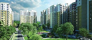 Skyline View of Rajpur Sonarpur from a Residential Project | |
| Coordinates: 22°26′57″N 88°23′29″E / 22.4491°N 88.3915°E | |
| Country | |
| State | West Bengal |
| Division | Presidency |
| District | South 24 Parganas |
| Region | Greater Kolkata |
| Established | 1876 |
| Government | |
| • Type | Municipality |
| • Body | Rajpur Sonarpur Municipality |
| Area | |
• Total | 49.26 km2 (19.02 sq mi) |
| Elevation | 9 m (30 ft) |
| Population (2011)[1] | |
• Total | 424,368 |
| • Density | 8,600/km2 (22,000/sq mi) |
| Languages | |
| • Official | Bengali[2][3] |
| • Additional official | English[2] |
| Time zone | UTC+5:30 (IST) |
| PIN | 700070, 700084, 700094, 700096, 700103, 700146, 700147, 700148, 700149, 700150, 700151, 700152, 700153, 700154 |
| Telephone code | +91 33 2427/2434/2477/2495 |
| Vehicle registration | WB-01 to WB-10, WB-19 to WB-22, WB-95 to WB-99 |
| Lok Sabha constituency | Jadavpur |
| Vidhan Sabha constituency | Sonarpur Uttar, Sonarpur Dakshin |
| Website | www |
Rajpur Sonarpur, popularly known as Sonarpur, is a city and a municipality of South 24 Parganas district in the Indian state of West Bengal. It is a part of the area covered by Kolkata Metropolitan Development Authority (KMDA). Rajpur and Sonarpur are two separate towns. Since the formation of the municipality, these two towns are known together as Rajpur Sonarpur. The city is well known for being the location of the Narendrapur Ramakrishna Mission, the ancestral house of Netaji Subhash Chandra Bose and the Bipadtarini Chandi Bari temple.
History
Many janapadas grew up along the old Bhagirathi channel from the ancient times till around the 16th century: Kalighat, Boral, Rajpur, Mahinagar, Baruipur, Bahadu, Joynagar, Majilpur, Chhatrabhog. Bipradas Pipilai’s Manasavijaya, composed in 1495, mentions many places in this region. “Chand Sadagar, a merchant character of Manasavijaya, reached Baruipur, from Kalighat, through the old Bhagirathi channel. From there he proceeded towards Chhatrabhog, and then traveling through Hatigarh pargana reached the open sea.” [4]
The area was home to the feudatory landlords (jamindars). The name Rajpur has been thus derived from the Bengali words Rajar Puri (রাজার পুরী) to Rajpuri and in this form to the now Rajpur. Being on the banks of the Adi Ganga (Old Ganges), Rajpur was one of the major locations of Bengal at that time. The proximity to Kolkata's southern district and being on the banks of Adi Ganga, which is just across the river made the place to be well connected. The old jamindar's house in Rajpur Harinavi is like the Roy Choudhury's. The family stayed in Rajpur. The Ramakrishna Mission, Belur Math set up an ashram in the Narendrapur area and made the school and college popularly known as Narendrapur Ramakrishna Mission. Rajpur is the ancestral place of the renowned Indian patriot and freedom fighter Netaji Subhash Chandra Bose.
Notable People
- The ancestral home of Sarat Chandra Bose and Subhas Chandra Bose was at Kodalia, a neighbourhood in Rajpur Sonarpur. Both of them were members of the first 24 Parganas District Committee of the Congress Party, which was formed in 1921.[5]
- Manabendra Nath Roy
- Rishi Rajnarayan Basu
- Salil Chowdhury
- Anurag Basu
- Kaushik Ganguly
- Churni Ganguly
- Locket Chatterjee
- Srijato
- Sunil Ganguly
- Kabir Suman
Geography

5miles
M: municipal city/ town, CT: census town, R: rural/ urban centre, N: neighbourhood
Owing to space constraints in the small map, the actual locations in a larger map may vary slightly
Area overview
Baruipur subdivision is a rural subdivision with moderate levels of urbanization. 31.05% of the population lives in the urban areas and 68.95% lives in the rural areas. In the northern portion of the subdivision (shown in the map alongside) there are 10 census towns. The entire district is situated in the Ganges Delta and the northern part of the subdivision is a flat plain bordering the metropolis of Kolkata.[6][7][8]
Note: The map alongside presents some of the notable locations in the subdivision. All places marked in the map are linked in the larger full screen map.
Location
Rajpur Sonarpur city is located at 22°26′57″N 88°23′29″E / 22.4491°N 88.3915°E. It has an average elevation of 9 metres (30 ft).
Danga and Ramchndrapur are adjacent to Rajpur Sonarpur city on its south-eastern side, as per the map of the Sonarpur CD block in the District Census Handbook for the South 24 Parganas.[9]
Petua, Panchghara, Mallikpur and Hariharpur form a cluster of census towns in the Baruipur CD block, as per the map of the Baruipur CD block in the District Census Handbook for the South 24 Parganas.[10]This cluster has Rajpur Sonarpur on the east and Bidyadharpur on the north, both in Sonarpur CD block, as per map of Sonarpur CD block in the District Census Handbook for South 24 Parganas.[11]
Demographics
Population
According to the 2011 Census of India, Rajpur Sonarpur city had a total population of 424,368, of which 215,405 (51%) were males and 208,963 (49%) were females. There were 35,274 persons in the age range of 0 to 6 years. The total number of literate persons was 350,721 which constituted 82.6% of the population with male literacy of 85.4% and female literacy of 79.8%. The effective literacy rate of 7+ population of Rajpur Sonarpur was 90.1%, of which male literacy rate was 93.2% and female literacy rate was 87.0%. The Scheduled Castes and Scheduled Tribes population was 78,655 and 2,340 respectively. Rajpur Sonarpur had 106604 households in 2011.[1]
Kolkata Urban Agglomeration
The following municipalities and census towns in the South 24 Parganas district were part of the Kolkata Urban Agglomeration in the 2011 census: Maheshtala (M), Joka (CT), Balarampur (CT), Chata Kalikapur (CT), Budge Budge (M), Nischintapur (CT), Uttar Raypur (CT), Pujali (M) and Rajpur Sonarpur (M).[12]
Commuters
With the electrification of the railways, suburban traffic has grown tremendously since the 1960s. As of 2005-06, more than 1.7 million (17 lakhs) commuters use the Kolkata Suburban Railway system daily. After the partition of India, refugees from East Pakistan/ Bangladesh had a strong impact on the development of urban areas in the periphery of Kolkata. The new immigrants depended on Kolkata for their livelihood, thus increasing the number of commuters. For the increasing facilities drawn by commuting, population in the peripheries of the metropolitan areas grew at a much faster rate than the metro core areas. During 1951 and 2011, population density has increased by only 1.5 times in the Kolkata Municipal Corporation area. In the Rajpur Sonarpur area, in the southern periphery of Kolkata, population density has increased 31 times during the same period. In the Baruipur urban area population density has increased by over 5 times.[13]
Major Localities and Landmarks
Kamalgazi is the centre and most developed area of this city. Boral is also a major locality of the city. A very old temple namely of historical importance (said to be as old as the reigns of the Sen rulers of Bengal, however the old construction has been ruined)- Tripurasundari Temple near Boral High School. Now Boral is also well known for the engineering institute Future Institute of Technology. In early 1953, the principal photography of the Satyajit Ray's debut film Pather Panchali was done at Boral, then a small village on the outskirts of Kolkata, now a locality of this city. A decade later, Ray again shot a scene of Goopy Gyne Bagha Byne in the dense bamboo groves near a local pond.[14]
The city also includes the localities of Malancha, Harinavi, Kodalia, Subhashgram, Boral, Nandan, Srirampur, Garia (partly), Narendrapur, Kamalgazi, Techno City, Panchpota, Model Town, Tentulberia, Ramgarh, Briji, Sreenagar, Balia, Fartabad, Kheadaha, Gangajoara, Hadia etc.
Recent Developments

Before the State Highway–1 (also known as E.M Bypass) project Rajpur Sonarpur was connected to Kolkata by N.S.C Bose Road (Netaji Subash Chandra Bose Road) and Garia Main Road. Which is a dream of distant past now after the construction of State Highway 1 and the Eastern Metropolitan Bypass easily connecting the place with the heart of Kolkata and the state highway to the rest of West Bengal.
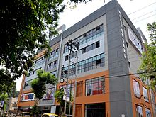
The city of Rajpur Sonarpur saw an immediate rush for land. It has also turned up in the recent real estate boom of the metropolis over the last 10 years Rajpur Sonarpur has developed into a popular residential community. Many multi-storied apartment complexes have been built (e.g.Srijoni Complex, Sherwood Estate, Mayfair Group Apartments, Sugam Park, South Winds Residential Complex, Deeshari Mega City, Victoria Greens, Siva Complex, Ozone) attracted by the amenities, as well as by the easy connectivity over the E M Bypass and State Highway-1. Newly constructed roads have made access to the area very easy. Many parts have turned up as a transportation gateway to Kolkata. The Hardware Park at the Sonarpur Chowhati, initiated by the Government of West Bengal is being built up in rapid speed.


Civic Administration
There is a Rajpur Sonarpur Municipality which is one of the oldest municipalities in the West Bengal. It is divided into 35 wards. As per 2015 municipal election, it is being controlled by the All India Trinamool Congress.[15]
Police station
Sonarpur police station covers an area of 169.816 sq km and has jurisdiction over the Sonarpur CD block and Rajpur Sonarpur municipal area.[16][17]
CD block HQ
The headquarters of the Sonarpur CD block are located at Sonarpur.[18]
Transport
The entire area of Rajpur Sonarpur is well connected through the State Highway - 1, Netaji Subash Chandra Bose Road and the Eastern Metropolitan Bypass. Garia, a part of Rajpur Sonarpur serves as the major connectivity point. From Garia, transportations like Buses, Kolkata Metro are available. Surface transport routes and many private bus routes ply from Garia to many important destinations via E.M Bypass and the main roads. There are also long distance bus routes specially the Digha bus route which also ply from Garia, Baruipur regularly.
Railway Transportation
Railway is the primary mode of transport of Rajpur Sonarpur. The entire area of Rajpur Sonarpur is served by the Kalikapur, Bidyadharpur, Subhashgram, Sonarpur Junction, Narendrapur, Garia and New Garia railway stations on the Sealdah–Sonarpur line of the Kolkata Suburban Railway. Sonarpur Junction is the main railway station of this entire area. It is one of the busiest railway stations of Sealdah railway division. More than 115 pairs of local trains ply through Sonarpur Junction on a daily basis. There are four platforms in this station. The only EMU carshed of Sealdah South section is present here.
Major Roads of Rajpur Sonarpur
- State Highway–1
- Eastern Metropolitan Bypass
- Southern Bypass
- Netaji Subash Chandra Bose Road
- Garia Main Road
- Garia Station Road
- Boral Main Road
- Rajpur–Joyenpur Road
- Sonarpur Station Road
- Sonarpur–Bantala Road
- Basanti Expressway
- Sonarpur–Rajpur Road (H.C. Sarani/ Aghore Sarani)
- Sonarpur–Tematha Road
- Gangajoara Main Road (Sonarpur Station to Garia Station Via Gangajoara)
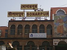
List of Metro Stations in Rajpur Sonarpur
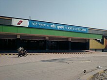
- Kavi Subhash (formerly New Garia)
- Shahid Khudiram (formerly Birji)
- Kavi Nazrul (formerly Garia Bazar)
List of Railway Stations in Rajpur Sonarpur/ Sonarpur CD block
Education
Sonarpur Mahavidyalaya, established in 1985, is affiliated to the University of Calcutta. It offers honours courses in Bengali, English, education. History, geography, philosophy, physiology, computer science and accounting & finance, and general courses in arts, science and commerce.[19]
There are many primary, secondary and higher secondary schools in this area. The institution Narendrapur Ramakrishna Mission, is one of the major schools and residential colleges of the city. The Ramakrishna Mission Residential College is an autonomous college of the city. Some schools are:[citation needed]


- Ramakrishna Mission Vidyalaya
- Future Institute of Engineering and Management
- Netaji Subhash Engineering College
- Meghnad Saha Institute of Technology
Healthcare
Sonarpur Rural Hospital, with 25 beds, is a major government medical facility in Sonarpur CD block.[20]
The Indian Institute of Liver and Digestive Sciences is a super speciality hospital that treats liver diseases. It has come up as a private initiative with government support.[21][22]
References
- ^ a b "Census of India: Rajpur Sonarpur". www.censusindia.gov.in. Retrieved 7 December 2019.
- ^ a b "Fact and Figures". Wb.gov.in. Retrieved 5 July 2019.
- ^ "52nd REPORT OF THE COMMISSIONER FOR LINGUISTIC MINORITIES IN INDIA" (PDF). Nclm.nic.in. Ministry of Minority Affairs. p. 85. Archived from the original (PDF) on 25 May 2017. Retrieved 5 July 2019.
- ^ "District Human Development Report: South 24 Parganas". Pages 3-4, Chapter I: South 24 Parganas: An overview. Department of Planning and Statistics, Government of West Bengal. Archived from the original on 5 October 2016. Retrieved 15 December 2019.
- ^ "District Human Development Report: South 24 Parganas". Page 7, Chapter I: South 24 Parganas: An overview. Department of Planning and Statistics, Government of West Bengal. Archived from the original on 5 October 2016. Retrieved 15 December 2019.
- ^ "District Statistical Handbook 2014 South Twety-four Parganas". Table 2.1 , 2.2, 2.4b. Department of Statistics and Programme Implementation, Government of West Bengal. Retrieved 5 December 2019.
- ^ "Census of India 2011, West Bengal, District Census Handbook, South Twentyfour Parganas, Series – 20, Part XII-A, Village and Town Directory" (PDF). Page 13, Physiography. Directorate of Census Operations, West Bengal. Retrieved 5 December 2019.
- ^ "District Human Development Report: South 24 Parganas". Chapter 9: Sundarbans and the Remote Islanders, p 290-311. Development & Planning Department, Government of West Bengal, 2009. Archived from the original on 5 October 2016. Retrieved 5 December 2019.
- ^ "Census of India 2011, West Bengal, District Census Handbook, South Twentyfour Parganas, Series – 20, Part XII-A, Village and Town Directory" (PDF). Page 257 - Map of Sonarpur CD block. Directorate of Census Operations, West Bengal. Retrieved 8 November 2019.
- ^ "Census of India 2011, West Bengal, District Census Handbook, South Twentyfour Parganas, Series – 20, Part XII-A, Village and Town Directory" (PDF). Page 383 - Map of Baruipur CD block. Directorate of Census Operations, West Bengal. Retrieved 7 November 2019.
- ^ "Census of India 2011, West Bengal, District Census Handbook, South Twentyfour Parganas, Series – 20, Part XII-A, Village and Town Directory" (PDF). Page 259 - Map of Sonarpur CD block. Directorate of Census Operations, West Bengal. Retrieved 7 November 2019.
- ^ "Provisional Population Totals, Census of India 2011" (PDF). Constituents of Urban Agglomeration Having Population Above 1 Lakh. Census of India 2011. Retrieved 7 November 2019.
- ^ Mondal, Bhaswati. "Commuting and Metropolitan Development of Kolkata". ResearchGate. Retrieved 16 December 2019.
- ^ "Apu Doesn't Live Here Anymore". Indian Express. 6 April 2013. Retrieved 22 August 2013.
- ^ "Rajpur-Sonarpur Municipality details as of JNNURM Official site of Department of Municipal Affairs". Retrieved 17 April 2015.
- ^ "Sonarpur police station". Baruipur police district. West Bengal police. Retrieved 18 October 2019.
- ^ "District Statistical Handbook 2014 South 24 Parganas". Table No. 2.1. Department of Statistics and Programme Implementation, Government of West Bengal. Retrieved 18 October 2019.
- ^ "BDO Offices under South 24 Parganas District". West Bengal Public Library Network, Government of West Bengal. Retrieved 18 October 2019.
- ^ "Sonarpur Mahavidyalaya". SM. Retrieved 29 October 2019.
- ^ "Health & Family Welfare Department" (PDF). Health Statistics – Rural Hospitals. Government of West Bengal. Retrieved 7 January 2020.
- ^ "Liver hospital to admit patients from May". The Telegraph, 5 April 2017. Retrieved 7 January 2020.
- ^ "Indian Institute of Liver and Digestive Sciences". Jaspital. Retrieved 7 January 2020.


