Eckbolsheim: Difference between revisions
Appearance
Content deleted Content added
m →References: add authority control |
No edit summary |
||
| Line 24: | Line 24: | ||
}} |
}} |
||
'''Eckbolsheim''' is a [[Communes of France|commune]], in the [[Bas-Rhin]] [[Departments of France|department]] in [[Grand Est]] in north-eastern [[France]]. |
'''Eckbolsheim''' ([[Alsatian dialect|Alsatian]]: ''Eckelse'') is a [[Communes of France|commune]], in the [[Bas-Rhin]] [[Departments of France|department]] in [[Grand Est]] in north-eastern [[France]]. |
||
==See also== |
==See also== |
||
Revision as of 23:48, 31 March 2020
You can help expand this article with text translated from the corresponding article in French. (December 2008) Click [show] for important translation instructions.
|
Eckbolsheim
Eckelse | |
|---|---|
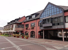
 The town hall in Eckbolsheim | |
| Coordinates: 48°34′47″N 7°41′25″E / 48.5797°N 7.6903°E | |
| Country | France |
| Region | Grand Est |
| Department | Bas-Rhin |
| Arrondissement | Strasbourg |
| Canton | Hœnheim |
| Intercommunality | Strasbourg Eurométropole |
| Government | |
| • Mayor (2008–2014) | André Lobstein |
Area 1 | 5.34 km2 (2.06 sq mi) |
| Population (2021)[1] | 7,199 |
| • Density | 1,300/km2 (3,500/sq mi) |
| Time zone | UTC+01:00 (CET) |
| • Summer (DST) | UTC+02:00 (CEST) |
| INSEE/Postal code | 67118 /67201 |
| Elevation | 139–154 m (456–505 ft) |
| 1 French Land Register data, which excludes lakes, ponds, glaciers > 1 km2 (0.386 sq mi or 247 acres) and river estuaries. | |
Eckbolsheim (Alsatian: Eckelse) is a commune, in the Bas-Rhin department in Grand Est in north-eastern France.
See also
References
- ^ "Populations légales 2021" (in French). The National Institute of Statistics and Economic Studies. 28 December 2023.
Wikimedia Commons has media related to Eckbolsheim.


