Rural Municipality of McCraney No. 282: Difference between revisions
→Demographics: 1981-2016 population history |
|||
| Line 77: | Line 77: | ||
== Demographics == |
== Demographics == |
||
{{stack| |
|||
{{Historical populations |
|||
| title = Population history<br/>(1981–2016) |
|||
| type = Canada |
|||
| align = right |
|||
| footnote = ''Source: [[Statistics Canada]] via Saskatchewan Bureau of Statistics''<ref name=Censuses81-06>{{cite web | url=http://www.stats.gov.sk.ca/stats/population/SaskCensusPopulation8106.pdf | title=Saskatchewan Census Population | publisher=Saskatchewan Bureau of Statistics | accessdate=May 9, 2020 | archive-url=https://web.archive.org/web/20150924105944/http://www.stats.gov.sk.ca/stats/population/SaskCensusPopulation8106.pdf | archive-date=September 24, 2015 | url-status=dead}}</ref><ref name=Censuses86-16>{{cite web | url=https://publications.saskatchewan.ca/enwiki/api/v1/products/86690/formats/100724/download | title=Saskatchewan Census Population | publisher=Saskatchewan Bureau of Statistics | accessdate=May 9, 2020}}</ref> |
|||
|1981|600 |
|||
|1986|588 |
|||
|1991|513 |
|||
|[[1996 Canadian Census|1996]]|478 |
|||
|[[2001 Canadian Census|2001]]|431 |
|||
|[[2006 Canadian Census|2006]]|346 |
|||
|[[2011 Canadian Census|2011]]|307 |
|||
|[[2016 Canadian Census|2016]]|310 |
|||
}} |
|||
}} |
|||
In the [[2016 Canadian Census|2016 Census of Population]] conducted by [[Statistics Canada]], the RM of McCraney No. 282 recorded a population of {{nts|310}} living in {{nts|127}} of its {{nts|133}} total private dwellings, a {{percentage|{{#expr:310-307}}|307|1}} change from its 2011 population of {{nts|307}}. With a land area of {{convert|948.55|km2|sqmi|abbr=on}}, it had a population density of {{Pop density|310|948.55|km2|sqmi|prec=1}} in 2016.<ref name=2016censusSKmunis>{{cite web | url=https://www12.statcan.gc.ca/census-recensement/2016/dp-pd/hlt-fst/pd-pl/Table.cfm?Lang=Eng&T=302&SR=1&S=86&O=A&RPP=9999&PR=47 | title=Population and dwelling counts, for Canada, provinces and territories, and census subdivisions (municipalities), 2016 and 2011 censuses – 100% data (Saskatchewan) | publisher=[[Statistics Canada]] | date=February 8, 2017 | accessdate=May 1, 2020}}</ref> |
In the [[2016 Canadian Census|2016 Census of Population]] conducted by [[Statistics Canada]], the RM of McCraney No. 282 recorded a population of {{nts|310}} living in {{nts|127}} of its {{nts|133}} total private dwellings, a {{percentage|{{#expr:310-307}}|307|1}} change from its 2011 population of {{nts|307}}. With a land area of {{convert|948.55|km2|sqmi|abbr=on}}, it had a population density of {{Pop density|310|948.55|km2|sqmi|prec=1}} in 2016.<ref name=2016censusSKmunis>{{cite web | url=https://www12.statcan.gc.ca/census-recensement/2016/dp-pd/hlt-fst/pd-pl/Table.cfm?Lang=Eng&T=302&SR=1&S=86&O=A&RPP=9999&PR=47 | title=Population and dwelling counts, for Canada, provinces and territories, and census subdivisions (municipalities), 2016 and 2011 censuses – 100% data (Saskatchewan) | publisher=[[Statistics Canada]] | date=February 8, 2017 | accessdate=May 1, 2020}}</ref> |
||
Revision as of 00:34, 10 May 2020
McCraney No. 282 | |
|---|---|
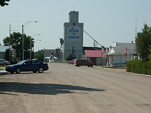
 Kenaston business district. | |
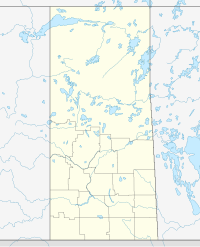
Location of McCraney No. 282 in Saskatchewan | |
| Coordinates: 51°29′41″N 106°04′54″W / 51.49472°N 106.08167°W | |
| Country | Canada |
| Province | Saskatchewan |
| Region | South-Central |
| Census division | 11 |
| Government | |
| • Governing body | McCraney Municipal Council |
| • Municipal seat | Consul |
| Area | |
• Total | 948.36 km2 (366.16 sq mi) |
| Population (2006) | |
• Total | 346 |
| • Density | 0.4/km2 (1/sq mi) |
| • Dwellings | 235 |
| Time zone | UTC-6 (UTC) |
| Area code | 306 |
| Website | mds.gov.sk.ca |
The Rural Municipality of McCraney No. 282 (2016 population: 310) is a rural municipality (RM) in the Canadian province of Saskatchewan within Census Division No. 11 and SARM Division No. 5. It is located in the south-central portion of the province.
Demographics
In the 2016 Census of Population conducted by Statistics Canada, the RM of McCraney No. 282 recorded a population of 310 living in 127 of its 133 total private dwellings, a 1% change from its 2011 population of 307. With a land area of 948.55 km2 (366.24 sq mi), it had a population density of 0.3/km2 (0.8/sq mi) in 2016.[3]
In the 2011 Census of Population, the RM of McCraney No. 282 recorded a population of 307, a -11.3% change from its 2006 population of 346. With a land area of 948.36 km2 (366.16 sq mi), it had a population density of 0.3/km2 (0.8/sq mi) in 2011.[4]
Communities and localities
The following urban municipalities are surrounded by the RM.
- none
- none
- none
The following unincorporated communities are located within the RM.
- Localities
See also
References
- ^ "Saskatchewan Census Population" (PDF). Saskatchewan Bureau of Statistics. Archived from the original (PDF) on September 24, 2015. Retrieved May 9, 2020.
- ^ "Saskatchewan Census Population". Saskatchewan Bureau of Statistics. Retrieved May 9, 2020.
- ^ "Population and dwelling counts, for Canada, provinces and territories, and census subdivisions (municipalities), 2016 and 2011 censuses – 100% data (Saskatchewan)". Statistics Canada. February 8, 2017. Retrieved May 1, 2020.
- ^ "Population and dwelling counts, for Canada, provinces and territories, and census subdivisions (municipalities), 2011 and 2006 censuses (Saskatchewan)". Statistics Canada. June 3, 2019. Retrieved May 1, 2020.
Template:Saskatchewan rural municipalities navbox


