Măgura, Teleorman: Difference between revisions
Appearance
Content deleted Content added
Infobox Romanian subdivision |
No edit summary |
||
| Line 23: | Line 23: | ||
| website = |
| website = |
||
}} |
}} |
||
'''Măgura''' is a [[communes of Romania|commune]] in [[Teleorman County]], [[Romania]]. It is composed of two villages, Guruieni and Măgura. |
'''Măgura''' is a [[communes of Romania|commune]] in [[Teleorman County]], [[Muntenia]], [[Romania]]. It is composed of two villages, Guruieni and Măgura. |
||
==References== |
==References== |
||
| Line 33: | Line 33: | ||
{{DEFAULTSORT:Magura, Teleorman}} |
{{DEFAULTSORT:Magura, Teleorman}} |
||
[[Category:Communes in Teleorman County]] |
[[Category:Communes in Teleorman County]] |
||
[[Category:Localities in Muntenia]] |
|||
{{Teleorman-geo-stub}} |
{{Teleorman-geo-stub}} |
||
Latest revision as of 14:19, 28 May 2020
Măgura | |
|---|---|
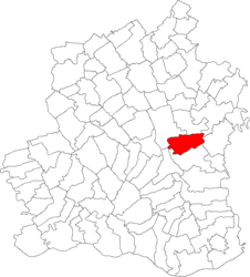
 Location in Teleorman County | |
| Coordinates: 44°02′N 25°24′E / 44.033°N 25.400°E | |
| Country | Romania |
| County | Teleorman |
| Subdivisions | Guruieni, Măgura |
| Population (2021-12-01)[1] | 2,299 |
| Time zone | EET/EEST (UTC+2/+3) |
| Vehicle reg. | TR |
Măgura is a commune in Teleorman County, Muntenia, Romania. It is composed of two villages, Guruieni and Măgura.


