Kuttippuram: Difference between revisions
Appearance
Content deleted Content added
Yamaguchi先生 (talk | contribs) Removed unsourced red link(s). WP:WTAF |
No edit summary |
||
| Line 6: | Line 6: | ||
| nickname = |
| nickname = |
||
| settlement_type = Town |
| settlement_type = Town |
||
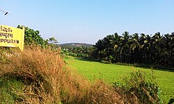
| image_skyline = Kuttippuram |
| image_skyline = Kuttippuram, Kerala,India.jpg |
||
| image_alt = |
| image_alt = |
||
| image_caption = Kuttippuram |
| image_caption = Kuttippuram |
||
| Line 52: | Line 52: | ||
==Geography== |
==Geography== |
||
[[Kuttippuram Bridge.jpg|thumb|Kuttippuram bridge]] |
|||
Kuttippuram is located at {{coord|10.83|N|76.07|E|}}.<ref>[http://www.fallingrain.com/world/IN/13/Kuttippuram.html Falling Rain Genomics, Inc - Kuttippuram]</ref> It has an average elevation of {{convert|15|m|ft|abbr=on}}. |
Kuttippuram is located at {{coord|10.83|N|76.07|E|}}.<ref>[http://www.fallingrain.com/world/IN/13/Kuttippuram.html Falling Rain Genomics, Inc - Kuttippuram]</ref> It has an average elevation of {{convert|15|m|ft|abbr=on}}. |
||
Revision as of 05:51, 26 June 2020
Kuttippuram | |
|---|---|
Town | |
 Kuttippuram | |
 | |
| Coordinates: 10°50′38″N 76°01′58″E / 10.84389°N 76.03278°E | |
| Country | |
| State | Kerala |
| District | Malappuram |
| Languages | |
| • Official | Malayalam, English |
| Time zone | UTC+5:30 (IST) |
Kuttippuram is a town and is situated in the Malappuram district of Kerala state, India. The town is located 34 kilometres south-west of Malappuram. The Bharathappuzha river flows through Kuttippuram.
Geography
thumb|Kuttippuram bridge Kuttippuram is located at 10°50′N 76°04′E / 10.83°N 76.07°E.[1] It has an average elevation of 15 m (49 ft).
Educational institutions
College(s)
References
External links
Wikimedia Commons has media related to Kuttippuram.
