Aldenhoven: Difference between revisions
Appearance
Content deleted Content added
Adding de: geodata... |
NumberOneOne (talk | contribs) No edit summary |
||
| Line 1: | Line 1: | ||
{| border="0" cellpadding="2" cellspacing="1" align="right" style="margin-left:1em; background-color: lightsteelblue;" |
|||
! Coat of arms |
|||
! Map |
|||
|- bgcolor="#FFFFFF" align="center" |
|||
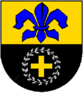
| style="width: 145px;" | [[Image:Wappen Aldenhoven.png|120px|Coat of arms of Aldenhoven]] |
|||
| style="width: 145px;" | [[Image:Lage der Gemeinde Aldenhoven in Deutschland.png|140px|Location of Aldenhoven in Germany]] |
|||
|} |
|||
'''Aldenhoven''' is a village and a municipality in the [[Düren (district)|district of Düren]] in the state of [[North Rhine-Westphalia]], [[Germany]]. It is located approx. 5 km south-west of [[Jülich]], 5 km north of [[Eschweiler]] and 20 km north-east of [[Aachen]]. |
'''Aldenhoven''' is a village and a municipality in the [[Düren (district)|district of Düren]] in the state of [[North Rhine-Westphalia]], [[Germany]]. It is located approx. 5 km south-west of [[Jülich]], 5 km north of [[Eschweiler]] and 20 km north-east of [[Aachen]]. |
||
Revision as of 16:02, 29 December 2006
| Coat of arms | Map |
|---|---|

|
Location of Aldenhoven in Germany |
Aldenhoven is a village and a municipality in the district of Düren in the state of North Rhine-Westphalia, Germany. It is located approx. 5 km south-west of Jülich, 5 km north of Eschweiler and 20 km north-east of Aachen.
