Marituba: Difference between revisions
Appearance
Content deleted Content added
GreenC bot (talk | contribs) Rescued 1 archive link. Wayback Medic 2.5 |
Bot: Removing c:File:Brasão de Marituba.png , deleted by Pi.1415926535 (Copyright violation, no indication of a free license on the source site (F1)). |
||
| Line 12: | Line 12: | ||
|image_flag = Flag_of_Marituba.svg |
|image_flag = Flag_of_Marituba.svg |
||
|flag_size = |
|flag_size = |
||
|image_seal = |
|image_seal = |
||
|seal_size = |
|seal_size = |
||
|image_map = Para Municip Marituba.svg |
|image_map = Para Municip Marituba.svg |
||
Revision as of 04:47, 8 August 2020
Municipality of Marituba
Marituba | |
|---|---|
Municipality | |
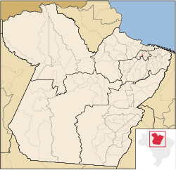
 Location in Pará and Brazil | |
| Coordinates: 01°21′18″S 48°20′31″W / 1.35500°S 48.34194°W | |
| Country | |
| Region | Northern |
| State | Pará |
| Mesoregion | Metropolitana de Belém |
| Founded | September 22, 1994 |
| Government | |
| • Mayor | Bertoldo Couto (PPS) |
| Area | |
• Total | 39.901 sq mi (103.343 km2) |
| Population (2018 est.)[3] | |
• Total | 129,321 |
| • Density | 3,200/sq mi (1,300/km2) |
| Time zone | UTC -3 |
| HDI' (2000) | 0.717 – medium[4] |
| Website | Official website |
Marituba is a municipality in the state of Pará in the Northern region of Brazil.[5][6] It is the smallest municipality of Pará and the smallest in all Northern Brazil.
See also
References
- ^ IBGE (10 October 2002). "Área territorial oficial". Resolução da Presidência do IBGE de n° 5 (R.PR-5/02). Retrieved 5 December 2010.
- ^ "Brazilian Institute of Geography and Statistics" (in Portuguese). 2017. Retrieved 27 March 2019.
2018 Area Total
- ^ "Brazilian Institute of Geography and Statistics" (PDF) (in Brazilian Portuguese). 2018. Retrieved 6 March 2019.
2018 Estimates of Population
- ^ "Ranking decrescente do IDH-M dos municípios do Brasil" (in Portuguese). Atlas do Desenvolvimento Humano, Programa das Nações Unidas para o Desenvolvimento (PNUD). 2000. Archived from the original on October 3, 2009. Retrieved December 17, 2009.
- ^ "Divisão Territorial do Brasil" (in Portuguese). Divisão Territorial do Brasil e Limites Territoriais, Instituto Brasileiro de Geografia e Estatística (IBGE). July 1, 2008. Archived from the original on June 14, 2020. Retrieved December 17, 2009.
- ^ "Produto Interno Bruto dos Municípios 2002-2005" (PDF) (in Portuguese). Instituto Brasileiro de Geografia e Estatística (IBGE). December 19, 2007. Archived from the original (PDF) on October 2, 2008. Retrieved December 17, 2009.
10°17′S 36°24′W / 10.283°S 36.400°W


