Keshapali: Difference between revisions
m →Gallery |
added skyline image and cleaned up |
||
| Line 13: | Line 13: | ||
| subdivision_name2 = [[Sambalpur district|Sambalpur]] |
| subdivision_name2 = [[Sambalpur district|Sambalpur]] |
||
| subdivision_type3 = [[Tehsil]] |
| subdivision_type3 = [[Tehsil]] |
||
| subdivision_name3 = |
|||
| unit_pref = Metric |
| unit_pref = Metric |
||
<!-- ALL fields with measurements have automatic unit conversion --> |
<!-- ALL fields with measurements have automatic unit conversion --> |
||
<!-- for references: use <ref>tags -->| elevation_m = |
<!-- for references: use <ref>tags -->| elevation_m = |
||
| population_as_of = 2011 |
| population_as_of = 2011 |
||
| population_footnotes = |
|||
| population_total = 832 |
| population_total = 832 |
||
<ref name="auto">{{Cite web |url=http://www.censusindia.gov.in/pca/Searchdata.aspx |title=Census of India: Search Details |website=www.censusindia.gov.in |access-date=2019-09-06}}</ref> |
<ref name="auto">{{Cite web |url=http://www.censusindia.gov.in/pca/Searchdata.aspx |title=Census of India: Search Details |website=www.censusindia.gov.in |access-date=2019-09-06}}</ref> |
||
| population_density_km2 = auto |
| population_density_km2 = auto |
||
| population_note = |
|||
| population_demonym = |
|||
| demographics_type1 = Languages |
| demographics_type1 = Languages |
||
| demographics1_title1 = Official |
| demographics1_title1 = Official |
||
| Line 36: | Line 32: | ||
| postal_code_type = <!-- [[Postal Index Number|PIN]] --> |
| postal_code_type = <!-- [[Postal Index Number|PIN]] --> |
||
| postal_code = 768105 |
| postal_code = 768105 |
||
| area_code_type = |
|||
| area_code = 768105 |
| area_code = 768105 |
||
| registration_plate = |
|||
| iso_code = |
|||
| blank1_name_sec2 = |
|||
| blank1_info_sec2 = |
|||
| website = {{URL|odisha.gov.in}} |
| website = {{URL|odisha.gov.in}} |
||
| footnotes = |
|||
| official_name = କେଶାପାଲି |
| official_name = କେଶାପାଲି |
||
| coordinates = {{coord|21.2089316|N|84.0212549|E|display=inline,title}} |
| coordinates = {{coord|21.2089316|N|84.0212549|E|display=inline,title}} |
||
| image_skyline = |
| image_skyline = File:Keshapali hill view.jpg |
||
| caption = |
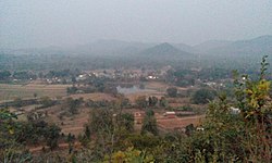
| caption = Picture taken from Gobadhan Hill of Keshapali |
||
| leader_party = |
|||
| elevation_ft = |
|||
| leader_name = Umakanth Mirdha <ref>https://odishapanchayat.gov.in/English/GPSarpanch.asp</ref> <ref>https://odishapanchayat.gov.in/english/Pdf/Sambalpur_GPSarpanchList_12-17.pdf</ref> |
| leader_name = Umakanth Mirdha <ref>https://odishapanchayat.gov.in/English/GPSarpanch.asp</ref> <ref>https://odishapanchayat.gov.in/english/Pdf/Sambalpur_GPSarpanchList_12-17.pdf</ref> |
||
| leader_title = [[Sarpanch]] |
| leader_title = [[Sarpanch]] |
||
Revision as of 11:33, 14 August 2020
Keshapali ( କେଶାପାଲି )
କେଶାପାଲି | |
|---|---|
Village | |
| କେଶାପାଲି | |
 Picture taken from Gobadhan Hill of Keshapali | |
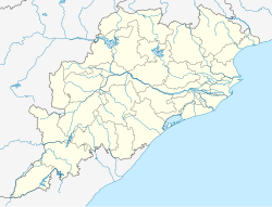
| Coordinates: 21°12′32″N 84°01′17″E / 21.2089316°N 84.0212549°E | |
| Country | |
| State | Odisha |
| District | Sambalpur |
| Government | |
| • Type | Panchayati raj (India) |
| • Body | Gram panchayat |
| • Sarpanch | Umakanth Mirdha [2] [3] |
| Population (2011) | |
• Total | 832 [1] |
| Languages | |
| • Official | Odia |
| • Other spoken | Sambalpuri, Hindi |
| Time zone | UTC+5:30 (IST) |
| Area code | 768105 |
| Website | odisha |
Keshapali is a small census village in Jujumura [4] Block of Sambalpur district of Indian state, Odisha. It is administered under Keshapali Grampanchayat and comes under the Jujumura Tahsil and it is a crucial booth of Rairakhol constituency.[1] The small village had a population of 832 in 2011. Keshapali has two Aganwadi centers, a primary school, a high school, a primary hospital and also a primary animal hospital. Goverdhan Puja is the famous festival of the village.
Goverment Offices
- Keshapali Panchayat Office [5]
- Post Office Keshapali [6]
- Revenue Office Keshapali [7]
- Primary Hospital Keshapali [8]
- Primary Animal Asylum
Education
There are two Anganwadi [9] Centers, namely Keshapali-A and Keshapali-B, where the children are taken care up-to 5 years old. A Primary School [10] is also in the village, where only three teaches are there for class 1 to 5. A Govt. High School [11] is also here. Hostel facility is also provided to girls belongs to SCs and STs category.
Gallery
-
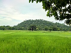
Keshapali govardhan parvat
-
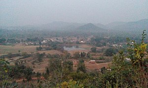
Keshapali Evening View
References
- ^ a b "Census of India: Search Details". www.censusindia.gov.in. Retrieved 2019-09-06.
- ^ https://odishapanchayat.gov.in/English/GPSarpanch.asp
- ^ https://odishapanchayat.gov.in/english/Pdf/Sambalpur_GPSarpanchList_12-17.pdf
- ^ http://rtiodisha.in/Pages/printAllManual/office_id:2347
- ^ https://www.worksodisha.gov.in/dpir_roadnetwrk_nc_sambalpur.html
- ^ https://www.postoffices.co.in/odisha-or-od-orissa/keshapali-jujumura-05-sambalpur/
- ^ http://www.revenueodisha.gov.in/?q=node/310
- ^ https://www.tabletwise.com/hospitals/health-centers-in-jujumara-sambalpur-odisha
- ^ http://gopabandhuacademy.gov.in/sites/default/files/gazetter/Sambalpur_Gazetteer.pdf
- ^ https://schools.org.in/sambalpur/21030601901/keshapali-ps.html
- ^ http://evidyalaya.mkcl.org/evidyalaya/Monitoring_Evidyalaya/pendingCaptureSchools?districtId=7a46b751-e461-4a84-bdf5-51c693430fed&year=2019&month=9


