Hababa, Syria: Difference between revisions
Appearance
Content deleted Content added
South Nashua (talk | contribs) stub |
Correction. |
||
| Line 1: | Line 1: | ||
{{About|a Syrian village in Duraykish District, Tartous Governorate|the Yemeni village|Hababah}} |
|||
{{Infobox settlement |
{{Infobox settlement |
||
<!--See the Table at Infobox Settlement for all fields and descriptions of usage--> |
<!--See the Table at Infobox Settlement for all fields and descriptions of usage--> |
||
<!-- Basic info ----------------> |
<!-- Basic info ----------------> |
||
|official_name = Hababa |
|official_name = Hababa |
||
|other_name = |
|other_name = |
||
|native_name |
|native_name = {{lang|ar|حَبَابَة}} |
||
| |
|native_name_lang = ar |
||
|settlement_type = Village<!--For Town or Village (Leave blank for the default City)--> |
|nickname = |
||
|settlement_type = Village<!--For Town or Village (Leave blank for the default City)--> |
|||
|motto = |
|motto = |
||
<!-- images and maps -----------> |
<!-- images and maps -----------> |
||
|image_skyline = |
|image_skyline = |
||
|imagesize = |
|imagesize = |
||
|image_caption = |
|image_caption = |
||
|image_flag = |
|image_flag = |
||
|flag_size = |
|flag_size = |
||
|image_seal = |
|image_seal = |
||
|seal_size = |
|seal_size = |
||
|image_shield = |
|image_shield = |
||
|shield_size = |
|shield_size = |
||
|image_blank_emblem = |
|image_blank_emblem = |
||
|blank_emblem_type = |
|blank_emblem_type = |
||
|blank_emblem_size = |
|blank_emblem_size = |
||
|image_map = |
|image_map = |
||
|mapsize = |
|mapsize = |
||
|map_caption = |
|map_caption = |
||
|image_map1 = |
|image_map1 = |
||
|mapsize1 = |
|mapsize1 = |
||
|map_caption1 = |
|map_caption1 = |
||
|image_dot_map = |
|image_dot_map = |
||
|dot_mapsize = |
|dot_mapsize = |
||
|dot_map_caption = |
|dot_map_caption = |
||
|dot_x = |dot_y = |
|dot_x = |dot_y = |
||
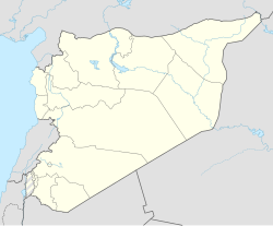
|pushpin_map = Syria <!-- the name of a location map as per http://en.wikipedia.org/wiki/Template:Location_map --> |
|pushpin_map = Syria#Middle East#Asia <!-- the name of a location map as per http://en.wikipedia.org/wiki/Template:Location_map --> |
||
|pushpin_label_position =bottom |
|pushpin_label_position = bottom |
||
|pushpin_mapsize =250 |
|pushpin_mapsize = 250 |
||
|pushpin_map_caption =Location in Syria |
|pushpin_map_caption = Location in Syria |
||
<!-- Location ------------------> |
<!-- Location ------------------> |
||
|subdivision_type = Country |
|subdivision_type = Country |
||
|subdivision_name = {{Flag|Syria}} |
|subdivision_name = {{Flag|Syria}} |
||
|subdivision_type1 = [[Governorates of Syria|Governorate]] |
|subdivision_type1 = [[Governorates of Syria|Governorate]] |
||
|subdivision_name1 = [[Tartous Governorate|Tartus]] |
|subdivision_name1 = [[Tartous Governorate|Tartus]] |
||
|subdivision_type2 = [[Districts of Syria|District]] |
|subdivision_type2 = [[Districts of Syria|District]] |
||
|subdivision_name2 = [[Duraykish District]] |
|subdivision_name2 = [[Duraykish District]] |
||
|subdivision_type3 = [[Nahiyah|Subdistrict]] |
|subdivision_type3 = [[Nahiyah|Subdistrict]] |
||
|subdivision_name3 = [[Hamin Subdistrict]] |
|subdivision_name3 = [[Hamin Subdistrict]] |
||
|subdivision_type4 = |
|subdivision_type4 = |
||
|subdivision_name4 = |
|subdivision_name4 = |
||
<!-- Politics -----------------> |
<!-- Politics -----------------> |
||
|government_footnotes = |
|government_footnotes = |
||
|government_type = |
|government_type = |
||
|leader_title = |
|leader_title = |
||
|leader_name = |
|leader_name = |
||
|leader_title1 |
|leader_title1 = <!-- for places with, say, both a mayor and a city manager --> |
||
|leader_name1 = |
|leader_name1 = |
||
|leader_title2 = |
|leader_title2 = |
||
|leader_name2 = |
|leader_name2 = |
||
|leader_title3 = |
|leader_title3 = |
||
|leader_name3 = |
|leader_name3 = |
||
|leader_title4 = |
|leader_title4 = |
||
|leader_name4 = |
|leader_name4 = |
||
|established_title |
|established_title = <!-- Settled --> |
||
|established_date = |
|established_date = |
||
|established_title2 |
|established_title2 = <!-- Incorporated (town) --> |
||
|established_date2 = |
|established_date2 = |
||
|established_title3 |
|established_title3 = <!-- Incorporated (city) --> |
||
|established_date3 = |
|established_date3 = |
||
<!-- Area ---------------------> |
<!-- Area ---------------------> |
||
|area_magnitude = |
|area_magnitude = |
||
|unit_pref =Metric <!--Enter: Imperial, if Imperial (metric) is desired--> |
|unit_pref = Metric <!--Enter: Imperial, if Imperial (metric) is desired--> |
||
|area_footnotes = |
|area_footnotes = |
||
|area_total_km2 = <!-- ALL fields dealing with a measurements are subject to automatic unit conversion--> |
|area_total_km2 = <!-- ALL fields dealing with a measurements are subject to automatic unit conversion--> |
||
|area_land_km2 = <!--See table @ Template:Infobox Settlement for details on automatic unit conversion--> |
|area_land_km2 = <!--See table @ Template:Infobox Settlement for details on automatic unit conversion--> |
||
|area_water_km2 = |
|area_water_km2 = |
||
|area_total_sq_mi = |
|area_total_sq_mi = |
||
|area_land_sq_mi = |
|area_land_sq_mi = |
||
|area_water_sq_mi = |
|area_water_sq_mi = |
||
|area_water_percent = |
|area_water_percent = |
||
|area_urban_km2 = |
|area_urban_km2 = |
||
|area_urban_sq_mi = |
|area_urban_sq_mi = |
||
|area_metro_km2 = |
|area_metro_km2 = |
||
|area_metro_sq_mi = |
|area_metro_sq_mi = |
||
|area_blank1_title = |
|area_blank1_title = |
||
|area_blank1_km2 = |
|area_blank1_km2 = |
||
|area_blank1_sq_mi = |
|area_blank1_sq_mi = |
||
<!-- Population -----------------------> |
<!-- Population -----------------------> |
||
|population_as_of = 2004 |
|population_as_of = 2004 |
||
|population_footnotes = |
|population_footnotes = |
||
|population_note = |
|population_note = |
||
|population_total = 769 |
|population_total = 769 |
||
|population_density_km2 = |
|population_density_km2 = |
||
|population_density_sq_mi = |
|population_density_sq_mi = |
||
|population_metro = |
|population_metro = |
||
|population_density_metro_km2 = |
|population_density_metro_km2 = |
||
|population_density_metro_sq_mi = |
|population_density_metro_sq_mi = |
||
|population_urban = |
|population_urban = |
||
|population_density_urban_km2 = |
|population_density_urban_km2 = |
||
|population_density_urban_sq_mi = |
|population_density_urban_sq_mi = |
||
|population_blank1_title =Ethnicities |
|population_blank1_title = Ethnicities |
||
|population_blank1 = |
|population_blank1 = |
||
|population_blank2_title =Religions |
|population_blank2_title = Religions |
||
|population_blank2 = |
|population_blank2 = |
||
|population_density_blank1_km2 = |
|population_density_blank1_km2 = |
||
|population_density_blank1_sq_mi = |
|population_density_blank1_sq_mi = |
||
<!-- General information ---------------> |
<!-- General information ---------------> |
||
|timezone |
|timezone = [[Eastern European Time|EET]] |
||
|utc_offset |
|utc_offset = +3 |
||
|timezone_DST |
|timezone_DST = [[Eastern European Summer Time|EEST]] |
||
|utc_offset_DST |
|utc_offset_DST = +2 |
||
|coordinates = {{coord|34|54|59|N|36|1|39|E|region:SY|display=inline,title}} |
|coordinates = {{coord|34|54|59|N|36|1|39|E|region:SY|display=inline,title}} |
||
|elevation_footnotes |
|elevation_footnotes = <!--for references: use <ref> </ref> tags--> |
||
|elevation_m = |
|elevation_m = |
||
|elevation_ft = |
|elevation_ft = |
||
<!-- Area/postal codes & others --------> |
<!-- Area/postal codes & others --------> |
||
|postal_code_type |
|postal_code_type = <!-- enter ZIP code, Postcode, Post code, Postal code... --> |
||
|postal_code = |
|postal_code = |
||
|area_code = |
|area_code = |
||
|blank_name_sec1 = City Qrya Pcode |
|blank_name_sec1 = City Qrya Pcode |
||
|blank_info_sec1 = C5605 |
|blank_info_sec1 = C5605 |
||
|website = |
|website = |
||
|footnotes = |
|footnotes = |
||
}} |
}} |
||
'''Hababa''' ({{lang-ar| |
'''Hababa''' ({{lang-ar|حَبَابَة}}) is a [[Syria]]n village in the [[Duraykish District]] in [[Tartous Governorate]]. According to the [[Central Bureau of Statistics (Syria)|Syria Central Bureau of Statistics]] (CBS), Hababa had a population of 769 in the 2004 census.<ref>{{cite web|title=General Census of Population 2004.|url=https://www.humanitarianresponse.info/sites/www.humanitarianresponse.info/files/syr_pop_2004_sycensus_0.xls |archive-url= |archivedate= |language= |accessdate= 2017-10-20}}</ref> |
||
==References== |
==References== |
||
Revision as of 06:50, 17 August 2020
Hababa
حَبَابَة | |
|---|---|
Village | |
| Coordinates: 34°54′59″N 36°1′39″E / 34.91639°N 36.02750°E | |
| Country | |
| Governorate | Tartus |
| District | Duraykish District |
| Subdistrict | Hamin Subdistrict |
| Population (2004) | |
• Total | 769 |
| Time zone | UTC+3 (EET) |
| • Summer (DST) | UTC+2 (EEST) |
| City Qrya Pcode | C5605 |
Hababa (Template:Lang-ar) is a Syrian village in the Duraykish District in Tartous Governorate. According to the Syria Central Bureau of Statistics (CBS), Hababa had a population of 769 in the 2004 census.[1]
References
- ^ "General Census of Population 2004". Retrieved 2017-10-20.


