Blairlogie: Difference between revisions
m add authority control |
Citation bot (talk | contribs) Add: chapter-url. Removed or converted URL. Some additions/deletions were actually parameter name changes. | You can use this bot yourself. Report bugs here. | Suggested by AManWithNoPlan | All pages linked from cached copy of User:AManWithNoPlan/sandbox2 | via #UCB_webform_linked |
||
| Line 32: | Line 32: | ||
At the foot of Castle Law (and giving its name to the hill) stood Blairlogie Castle, built in 1543 by Alexander Spittal and surviving until the early 20th century. The castle and surrounding estate was purchased by Lt Col Hare of Calder Hall in 1891 who extensively rebuilt it.<ref>Logie: A Parish History by Menzies Fergusson</ref> |
At the foot of Castle Law (and giving its name to the hill) stood Blairlogie Castle, built in 1543 by Alexander Spittal and surviving until the early 20th century. The castle and surrounding estate was purchased by Lt Col Hare of Calder Hall in 1891 who extensively rebuilt it.<ref>Logie: A Parish History by Menzies Fergusson</ref> |
||
An abandoned copper mine lies to the east of the village.<ref>{{cite book |author=Geological Survey of Great Britain |title=Special Reports on the Mineral Resources of Great Britain |date=1920 |publisher=Stationery Office |chapter= Volume 17: The lead, zinc, copper and nickel ores of Scotland|pages=142 |url=https://books.google. |
An abandoned copper mine lies to the east of the village.<ref>{{cite book |author=Geological Survey of Great Britain |title=Special Reports on the Mineral Resources of Great Britain |date=1920 |publisher=Stationery Office |chapter= Volume 17: The lead, zinc, copper and nickel ores of Scotland|pages=142 |chapter-url=https://books.google.com/books?id=8dERAAAAIAAJ&pg=RA1-PA142}}</ref> |
||
[[File:Old Drovers Path at Cotkerse.jpg|thumb|left|Old drove track at Cotkerse by Blairlogie]] |
[[File:Old Drovers Path at Cotkerse.jpg|thumb|left|Old drove track at Cotkerse by Blairlogie]] |
||
Revision as of 23:07, 21 September 2020
Blairlogie
| |
|---|---|
 Blairlogie House | |
Location within the Stirling council area | |
| Population | 58 |
| OS grid reference | NS829968 |
| Civil parish | |
| Council area | |
| Lieutenancy area | |
| Country | Scotland |
| Sovereign state | United Kingdom |
| Post town | Stirling |
| Postcode district | FK9 |
| Dialling code | 01259 |
| Police | Scotland |
| Fire | Scottish |
| Ambulance | Scottish |
| UK Parliament | |
| Scottish Parliament | |
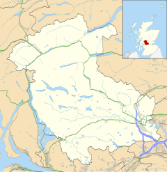
Blairlogie is a village in the Stirling council area of Scotland, situated at the base of the great southern rock-face of Dumyat between Stirling and Menstrie.
Blairlogie forms part of the parish of the ancient Logie Kirk which lies to its west. It comprises mainly 17th-19th century cottages and was one of central Scotland's earliest Conservation villages.[1]
At the foot of Castle Law (and giving its name to the hill) stood Blairlogie Castle, built in 1543 by Alexander Spittal and surviving until the early 20th century. The castle and surrounding estate was purchased by Lt Col Hare of Calder Hall in 1891 who extensively rebuilt it.[2]
An abandoned copper mine lies to the east of the village.[3]

Between 1598 and 1609, the minister of Logie Kirk was the poet Alexander Hume.[1]
The Scottish International rugby player Kenny Logan used to live in the village and several of his relatives live in the area.
References
- ^ a b "Blairlogie: Overview". Gazetteer for Scotland. Retrieved 24 November 2018.
- ^ Logie: A Parish History by Menzies Fergusson
- ^ Geological Survey of Great Britain (1920). "Volume 17: The lead, zinc, copper and nickel ores of Scotland". Special Reports on the Mineral Resources of Great Britain. Stationery Office. p. 142.
External links

