Subalaya: Difference between revisions
Appearance
Content deleted Content added
ce flow (AGF on info) |
m ce |
||
| Line 61: | Line 61: | ||
| footnotes = |
| footnotes = |
||
}} |
}} |
||
'''Subalaya''' is a town in the [[Birmaharajpur]] subdivision of [[Subarnapur district]], [[Odisha]], [[India]]. It is located on an island {{convert|822.738|acres|km2}} in size<ref>[https://web.archive.org/web/20090411014712/http://orissagov.nic.in/revenue/ADMN_UNIT/Sonepur/Birmaharajpur/Subalaya.htm Subalaya Land Area Chart (archive)]</ref> |
'''Subalaya''' is a town in the [[Birmaharajpur]] subdivision of [[Subarnapur district]], [[Odisha]], [[India]]. It is located on an island {{convert|822.738|acres|km2}} in size<ref>[https://web.archive.org/web/20090411014712/http://orissagov.nic.in/revenue/ADMN_UNIT/Sonepur/Birmaharajpur/Subalaya.htm Subalaya Land Area Chart (archive)]</ref> at the confluence of the [[Mahanadi river]] and [[Surubalijora]].<ref>http://offerings.nic.in/directory/adminreps/viewGPmapcvills.asp?gpcode=121864</ref> |
||
This town is home to [[Subalaya High School]] and [[Subalaya College]]. |
This town is home to [[Subalaya High School]] and [[Subalaya College]]. |
||
Revision as of 10:37, 14 October 2020
Subalaya
Sublia | |
|---|---|
Town | |
| Coordinates: 20°53′N 84°10′E / 20.883°N 84.167°E | |
| Country | |
| State | Odisha |
| District | Subarnapur |
| Area | |
• Total | 3.32950 km2 (1.28553 sq mi) |
| Languages | |
| • Official | Odia |
| Time zone | UTC+5:30 (IST) |
| Vehicle registration | OD-31 |
| Nearest city | Birmaharajpur, Rairakhol |
| Lok Sabha constituency | Balangir |
| Climate | Rainy, hot, cold (Köppen) |
| Avg. summer temperature | 45–50 °C (113–122 °F) |
| Avg. winter temperature | 20–25 °C (68–77 °F) |
| Website | odisha |
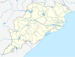
Subalaya is a town in the Birmaharajpur subdivision of Subarnapur district, Odisha, India. It is located on an island 822.738 acres (3.32950 km2) in size[1] at the confluence of the Mahanadi river and Surubalijora.[2]
This town is home to Subalaya High School and Subalaya College.
References


