Isiala-Ngwa South: Difference between revisions
Tags: Mobile edit Mobile web edit |
Tags: Mobile edit Mobile web edit |
||
| Line 202: | Line 202: | ||
===Amaise=== |
===Amaise=== |
||
Aga |
*Aga |
||
Amaokpu |
*Amaokpu |
||
Nnoyi |
*Nnoyi |
||
Umuekene |
*Umuekene |
||
Umunwarida |
*Umunwarida |
||
== Note == |
|||
The [[postal code]] of the area is 451.<ref>{{cite web | title = Post Offices- with map of LGA | work = | publisher = NIPOST | url = http://www.nipost.gov.ng/Postoffice.aspx | accessdate = 2009-10-20 | archive-url = https://web.archive.org/web/20090926064311/http://www.nipost.gov.ng/Postoffice.aspx | archive-date = 2009-09-26 | url-status = dead }}</ref> |
The [[postal code]] of the area is 451.<ref>{{cite web | title = Post Offices- with map of LGA | work = | publisher = NIPOST | url = http://www.nipost.gov.ng/Postoffice.aspx | accessdate = 2009-10-20 | archive-url = https://web.archive.org/web/20090926064311/http://www.nipost.gov.ng/Postoffice.aspx | archive-date = 2009-09-26 | url-status = dead }}</ref> |
||
Revision as of 10:50, 24 October 2020
Isiala Ngwa South | |
|---|---|
 | |
| Country | |
| State | Abia State |
| Capital | Omoba |
| Area | |
• Total | 100 sq mi (258 km2) |
| Population (2006) | |
• Total | 134,762 |
| Time zone | UTC+1 (WAT) |
| Website | Official Website |
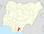
Isiala Ngwa South is a Local Government Area of Abia State, Nigeria. Its headquarters are in the town of Omoba. Omoba is the spelling gotten from the pronunciation of the White man, originally it is "UMUOBA" as "UMU" in Igbo Language means "children". The Igbo Race has "UMU" attached to most of their villages and Towns. This was a way of naming a People, Example UMU-EKEGWU meaning "The Children of EKEGWU".
The National Integrated Power Project [NIPP] saw the building of a sub-power station at the heart of Omoba which has improved power supply within the town in recent times.
It has an area of 258 km² and a population of 134,762 at the 2006 census. The first executive chairman is Chief Damian Ozurumba.
List of Towns and Villages
Ovu-Ngwa
- Agbaragwu
- Amaede
- Ele-na-Ekpu
- Iheneriala
- Ngwama
- Okpungwu
- Umuaja
- Umuakpor
- Umuapu I
- Umuapu II
- Umuejije
- Umuihi
- Umuotiri
- Umuukuru
Osokwa – Nvosi
- Umuetegha
- Iheoji
- Ikem
- Mgbogbo-Ndiolumbe
- Nkpuruta-Ndiolumbe
- Ntigha
- Ogele-Ukwu
- Umuabali
- Umuada
Isiala Nvosi
- Amaiyi
- Amaku
- Ebeyi
- Kputuke
- Eziama
- Mgbokonta
- Obuba
- Ohuhu Ekwuru
- Umuawuru
- Umuofa
- Umuehim
- Umuejea
- Umuguru
- Umunevo
- Umunko
- Umunkpeyi
- Umunwanbi
- Umuobefu
- Umuogele
- Umuokiri
- Umuokpogho
- Umuomacha
- Umuezu
Ovu-Okwu
- Amauha
- Obiekwensu
- Okpuala
- Ovorji
- Umiri
- Umuakwa
- Umuegoro
- Umueleghele
- Umuene
- Umuowa
- Umurasi
Omoba
- Umugba
- Umuagu
- Umuamosi
- Umuezechi
- Umuikea
- Umuire
- Umuokoroukwu
- Umuoleihe
- Umu-Ekegwu
Okporo Ahaba
- Amuke
- Mba
- Mbutu Umuoke
- Okpuhie
- Umuajuju
- Umuakuma
- Umuenere
- Umuhie
- Umuoko
Mbutu
- Amankwo
- Egbelu-Mnbutu/Umuokere
- Obekwesu
- Okungwu
- Owerrinta
- Uhum
- Umogwu
- Umuduru
- Umuekwe
- Umueleke
- Umuezeocha
- Umuichi
- Umuocheala-Umuokorie
- Umuojima Efene
- Umuojima-Ukwu
- Umuokwu Umuagu
- Umuosisi
- Umuosoala
- Waterside
Amaise-Ahaba
- Mabedeala
- Nkpuka
- Umuacha
- Umuikaa
- Umuvo
Ngwa
- Amaudara
- Umuala
- Umuebi
- Umuezeoji
- Umundogu
- Umunta
Amaise
- Aga
- Amaokpu
- Nnoyi
- Umuekene
- Umunwarida
Note
The postal code of the area is 451.[1]
References
- ^ "Post Offices- with map of LGA". NIPOST. Archived from the original on 2009-09-26. Retrieved 2009-10-20.

