Koshoy Korgon: Difference between revisions
Appearance
Content deleted Content added
No edit summary |
पाटलिपुत्र (talk | contribs) {{Central Asian history}}, maps |
||
| Line 21: | Line 21: | ||
| image_map_alt = |
| image_map_alt = |
||
| image_map_caption = |
| image_map_caption = |
||
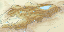
| pushpin_map = Kyrgyzstan |
| pushpin_map = Kyrgyzstan#West Asia#Asia |
||
| pushpin_mapsize = |
| pushpin_mapsize = |
||
| pushpin_map_alt = |
| pushpin_map_alt = |
||
| pushpin_map_caption = |
| pushpin_map_caption = |
||
| pushpin_relief = |
| pushpin_relief = yes |
||
| pushpin_image = |
| pushpin_image = |
||
| pushpin_label = |
| pushpin_label = |
||
| Line 68: | Line 68: | ||
{{Kyrgyzstan-struct-stub}} |
{{Kyrgyzstan-struct-stub}} |
||
{{CAsia-archaeology-stub}} |
{{CAsia-archaeology-stub}} |
||
{{Central Asian history}} |
|||
Revision as of 08:49, 29 November 2020
| Koshoy Korgon | |
|---|---|
Кошой Коргон | |
| At-Bashy District Near Kara-Suu in Kyrgyzstan | |
 Qoshoy Qorgon from the outside (northeast), looking south. | |
 Qoshoy Qorgon from the inner northern corner, looking south-east. The on-site museum is visible in the background. | |
| Coordinates | 41°07′23″N 75°42′01″E / 41.1230°N 75.7004°E |
| Type | Fortress |
| Site information | |
| Condition | Ruined |
| Site history | |
| Materials | Mud |
Koshoy Korgon or Qoshoy Qorgon (Template:Lang-ky [qoʃoj qorʁón]) is a ruined fortress of uncertain date located in At-Bashy District, Kyrgyzstan. The structure, which consists of walls made of mud enclosing a large area and is identified as a korgon ("fortress", not to be confused with a kurgan), is immediately to the southeast of Kara-Suu village, and a little ways west of At-Bashy village. It is named after Qoshoy baatyr, one of Manas's generals, who is thought to have been a catalyst for its construction. There is an on-site museum for tourists that is rarely open.
References


