Mitla Pass: Difference between revisions
m v2.03b - Bot 22 bogus-image-options - WP:WCW project (Bogus image options) |
m →top: Task 24: replacement of Template:Lang-he-n following a TFD |
||
| Line 16: | Line 16: | ||
}} |
}} |
||
The '''Mitla Pass''' ({{lang-ar|ممر متلة}}, {{lang-he |
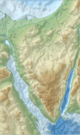
The '''Mitla Pass''' ({{lang-ar|ممر متلة}}, {{lang-he|מיתלה}}) is a {{convert|480|m|ft|adj=mid|-high}} [[mountain pass|pass]] snaking {{convert|32|km|mi}} in the [[Sinai Peninsula]] of [[Egypt]], wedged between mountain ranges to the north and south. It is located about {{convert|50|km|mi}} east of [[Suez]]. It is the monotonous ride through here and [[Nekhel]], a wilderness that provides the shortest route between [[Nuweiba]] and [[Cairo]].<ref name="TowardsStCatherines">{{cite book|last1=Richardson|first1=Dan|title=Sinai Rough Guides Snapshot Egypt (includes Sharm el-Sheikh, Na'ama Bay, Ras Mohammed, Dahab, Mount Sinai and St Catherine's Monastery)|date=2013|publisher=Penguin|isbn=9781409336174|url=https://books.google.com/books?id=BZnqZFNbK3YC&pg=PT68&dq=Mitla+Pass&hl=es&sa=X&ved=0ahUKEwiB87u0k4jQAhVX82MKHVIaCW8Q6AEIUjAH#v=onepage&q=Mitla%20Pass&f=false|accessdate=1 November 2016}}</ref> Buses carrying tourist to [[Mount Sinai]], [[St. Catherine's Monastery]], and [[Feiran Oasis]] travel through here.<ref name="RoughGuide">{{cite book|last1=Richardson|first1=Dan|title=Egypt|date=2003|publisher=Rough Guides|isbn=9781843530503|url=https://archive.org/details/roughguidetoegyp00danr|url-access=registration|page=[https://archive.org/details/roughguidetoegyp00danr/page/n698 675]|quote=Egypt Rough Guide.|accessdate=1 November 2016}}</ref> |
||
[[File:Aerial view of the road through Mitla Pass dotted with wrecked Egyptian vehicles and armour after Israel air force attacks. June 1967. D326-013.jpg|thumb|left|Aerial view of the road through Mitla Pass dotted with wrecked Egyptian vehicles and armour after Israeli air force attacks in June 1967.]]Mitla Pass is a site of major battles between the militaries of [[Egypt]] and [[Israel]] during the wars of [[Suez Crisis|1956]], [[Six-Day War|1967]], and [[Yom Kippur War|1973]]. During the last of these, on October 14, 1973, the Egyptians tried to reach the pass with elements of their Fourth Armored Division, but their offensive was halted by IDF armor and air power. Figures of Egyptian tank losses vary with the source consulted. ''The Two O'Clock War'' gives the Israeli figure but the Egyptian one is lower.<ref name="Dayan" /> |
[[File:Aerial view of the road through Mitla Pass dotted with wrecked Egyptian vehicles and armour after Israel air force attacks. June 1967. D326-013.jpg|thumb|left|Aerial view of the road through Mitla Pass dotted with wrecked Egyptian vehicles and armour after Israeli air force attacks in June 1967.]]Mitla Pass is a site of major battles between the militaries of [[Egypt]] and [[Israel]] during the wars of [[Suez Crisis|1956]], [[Six-Day War|1967]], and [[Yom Kippur War|1973]]. During the last of these, on October 14, 1973, the Egyptians tried to reach the pass with elements of their Fourth Armored Division, but their offensive was halted by IDF armor and air power. Figures of Egyptian tank losses vary with the source consulted. ''The Two O'Clock War'' gives the Israeli figure but the Egyptian one is lower.<ref name="Dayan" /> |
||
Revision as of 19:52, 6 December 2020
| Mitla Pass | |
|---|---|
 The Mitla pass in 1920 looking east from the plain | |
| Elevation | 480 m (1,575 ft) |
| Traversed by | Route 50 |
| Location | Sinai |
| Coordinates | 30°0′52.4″N 32°53′0.4″E / 30.014556°N 32.883444°E |
The Mitla Pass (Template:Lang-ar, Template:Lang-he) is a 480-metre-high (1,570 ft) pass snaking 32 kilometres (20 mi) in the Sinai Peninsula of Egypt, wedged between mountain ranges to the north and south. It is located about 50 kilometres (31 mi) east of Suez. It is the monotonous ride through here and Nekhel, a wilderness that provides the shortest route between Nuweiba and Cairo.[1] Buses carrying tourist to Mount Sinai, St. Catherine's Monastery, and Feiran Oasis travel through here.[2]

Mitla Pass is a site of major battles between the militaries of Egypt and Israel during the wars of 1956, 1967, and 1973. During the last of these, on October 14, 1973, the Egyptians tried to reach the pass with elements of their Fourth Armored Division, but their offensive was halted by IDF armor and air power. Figures of Egyptian tank losses vary with the source consulted. The Two O'Clock War gives the Israeli figure but the Egyptian one is lower.[3]
Mitla incident during the Suez War
During the Israeli invasion of Egypt in the Suez War of 1956 the pass was captured by the 202nd Brigade of the Israeli army, commanded by Ariel Sharon, without the approval of the Israeli leadership. Sharon faced elements of the Egyptian 2nd Brigade, which had prepared an ambush within the pass. Egyptians pinned down such famous Israelis as Mordechai Gur and Uri Dan under fire throughout the afternoon of October 31, 1956. Aharon Davidi and Rafael Eitan sent in two companies to clear Egyptians from both sides of the pass between 6:00pm and 9:00pm that evening. Israelis suffered 40 casualties and about 120 wounded, while Egyptians had 260 dead. Sharon was criticized for this.[3]
See also
References
- ^ Richardson, Dan (2013). Sinai Rough Guides Snapshot Egypt (includes Sharm el-Sheikh, Na'ama Bay, Ras Mohammed, Dahab, Mount Sinai and St Catherine's Monastery). Penguin. ISBN 9781409336174. Retrieved 1 November 2016.
- ^ Richardson, Dan (2003). Egypt. Rough Guides. p. 675. ISBN 9781843530503. Retrieved 1 November 2016.
Egypt Rough Guide.
- ^ a b Bar-On, Mordechai (June 26, 2012). Moshe Dayan: Israel's Controversial Hero. Yale University Press. ISBN 9780300183252. Retrieved 1 November 2016.
Further reading
![]() Media related to Mitla pass at Wikimedia Commons
Media related to Mitla pass at Wikimedia Commons
- Walter J. Boyne (2002). The Two O'Clock War: The 1973 Yom Kippur Conflict and the Airlift That Saved Israel. Thomas Dunne Books. ISBN 978-0312273033.

