Alabato: Difference between revisions
Appearance
Content deleted Content added
JJMC89 bot (talk | contribs) Migrate {{Infobox settlement}} coordinates parameters to {{Coord}}, see Wikipedia:Coordinates in infoboxes |
No edit summary |
||
| Line 38: | Line 38: | ||
|footnotes = |
|footnotes = |
||
}} |
}} |
||
'''Alabato''' is a village in the [[Oio Region]] of northern [[Guinea-Bissau]]. It is located east of [[Cufeu]].<ref>{{cite map|title=[[Google Maps]]|publisher=Google}}</ref><ref>{{cite map|title=[[Bing Maps]]|publisher= [[Microsoft]] and [[Harris Corporation]] Earthstar Geographics LLC}}</ref> |
'''Alabato''' is a village in the [[Oio Region]] of northern [[Guinea-Bissau]]. |
||
==Location== |
|||
It is located east of [[Cufeu]].<ref>{{cite map|title=[[Google Maps]]|publisher=Google}}</ref><ref>{{cite map|title=[[Bing Maps]]|publisher= [[Microsoft]] and [[Harris Corporation]] Earthstar Geographics LLC}}</ref> |
|||
==References== |
==References== |
||
Revision as of 14:53, 24 December 2020
Alabato | |
|---|---|
Village | |
| Coordinates: 12°29′21″N 15°21′20″W / 12.48917°N 15.35556°W | |
| Country | |
| Region | Oio Region |
| Sector | Farim |
| Time zone | UTC+0 (GMT) |
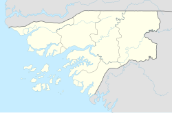
Alabato is a village in the Oio Region of northern Guinea-Bissau.
Location
It is located east of Cufeu.[1][2]
References
- ^ Google Maps (Map). Google.
- ^ Bing Maps (Map). Microsoft and Harris Corporation Earthstar Geographics LLC.

