Japan National Route 367: Difference between revisions
Appearance
Content deleted Content added
Mccunicano (talk | contribs) added next/previous routes |
m Task 18 (cosmetic): eval 1 template: hyphenate params (1×); |
||
| Line 9: | Line 9: | ||
|length_km=68.5 |
|length_km=68.5 |
||
|length_round= |
|length_round= |
||
|length_ref=<ref>{{cite web|title=一般国道の路線別、都道府県別道路現況|trans-title=Road statistics by General National Highway route and prefecture|url=http://www.mlit.go.jp/road/ir/ir-data/tokei-nen/2016/pdf/d_genkyou26.pdf|language=ja|publisher=Ministry of Land, Infrastructure, Transport and Tourism| |
|length_ref=<ref>{{cite web|title=一般国道の路線別、都道府県別道路現況|trans-title=Road statistics by General National Highway route and prefecture|url=http://www.mlit.go.jp/road/ir/ir-data/tokei-nen/2016/pdf/d_genkyou26.pdf|language=ja|publisher=Ministry of Land, Infrastructure, Transport and Tourism|access-date=12 February 2020}}</ref> |
||
|established= |
|established= |
||
|direction_a= |
|direction_a= |
||
Revision as of 17:07, 9 January 2021
| National Route 367 | ||||
|---|---|---|---|---|
| 国道367号 | ||||
 | ||||
| Route information | ||||
| Length | 68.5 km[1] (42.6 mi) | |||
| Location | ||||
| Country | Japan | |||
| Highway system | ||||
| ||||
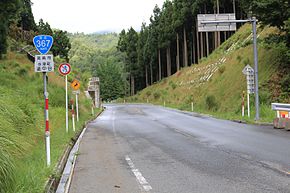
National Route 367 is a national highway of Japan connecting between Shimogyō-ku, Kyoto and Wakasa, Fukui in Japan, with total length has 68.5 km (42.56 mi).
References
- ^ "一般国道の路線別、都道府県別道路現況" [Road statistics by General National Highway route and prefecture] (PDF) (in Japanese). Ministry of Land, Infrastructure, Transport and Tourism. Retrieved 12 February 2020.

