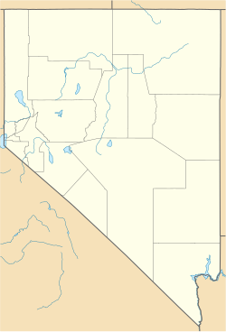
Roach, Nevada
Roach | |
|---|---|
| Coordinates: 35°38′27″N 115°21′33″W / 35.64083°N 115.35917°W | |
| Country | United States |
| State | Nevada |
| County | Clark |
| Founded | circa 1902 |
| Elevation | 2,620 ft (800 m) |
| Population (1940) | |
• Total | 10 |
| Time zone | UTC-8 (PST) |
| • Summer (DST) | UTC-7 (PDT) |
Roach is a ghost town and railroad siding in Clark County, Nevada, United States. It is located along the Union Pacific Railroad, between Jean, Nevada and Nipton, California.
History

Roach was settled between 1902 and 1905.[1] In 1904, a tractor road from the Mesquite Valley through State Line Pass to Roach was built, "largely to haul borax from the Death Valley region; but it also served to permit easy shipment of the ores from mines in the southwestern part" of the Goodsprings Mining District.[2] Roach became a major shipping point on the San Pedro, Los Angeles and Salt Lake (SPLA & SL) Railroad, with "considerable tonnage" being shipped through Roach around 1913, along with nearby Jean and Arden.[3]
The Roach Station was the closest rail site to the Milford-Addison group of mines c. 1915.[4] Around that time, lead-zinc ore was also mined at the Mobile Mine, owned by a Los Angeles syndicate, and shipped to Los Angeles via the station at Roach.[5]
In 1915, about 500 tons of zinc carbonite ore were being transported each month via trucks from the Green Monster Mine to Roach. The following year, the Mojave Tungsten Company planned to build a tungsten plant 20 miles west of Roach, with L.L. Draper as the superintendent.[6][7]
Roach was noted as the site of a 1916 record-breaking event. Roy Sorenson and Fred Piehl, leaseholders on the Addison Mine, hired a team to haul 55 tons of zinc to the station at Roach, which the Goldfield News declared a hauling record. The team worked continuously for almost 42 hours to deposit the ore before Sorenson and Piehl's lease on the mine expired.[8]
By the 1920s, Roach was still considered an "important" shipping point on the rail line.[9] The Las Vegas Aviation Club offered landings at Roach around 1921.[10]
Roach had a population of 10 residents c. 1940.[1]
Roach appears on, and is the namesake for, the USGS Roach 7.5' topographic map (1985).[11]
Geography
Roach is on the eastern shoreline of Roach Dry Lake and has an elevation of 2,620 feet (800 m).[12]
References
- ^ a b "Origin of Place Names - Nevada" (PDF). Nevada State Writers' Project Works Project Administration. 1941. Retrieved 1 November 2021.
- ^ "Goodsprings Mining District, Spring Mountains, Clark County, Nevada, USA". www.mindat.org. Retrieved 2021-11-09.
- ^ "Lead-Zinc Mines Are Paying Well". Reno Evening Gazette. Reno, Nevada. 1913-04-30. p. 10. Retrieved 2021-11-09.
- ^ Nevius, J. Nelson, ed. (1915). Oil and Mining Bulletin. Los Angeles, California: Western Pythian Publishing Company. pp. 89–90.
- ^ "Mining Operations Going on in Goodsprings, Nev., Mining District". Goldfield News And Weekly Tribune. Goldfield, Nevada. 1914-04-04. p. 5. Retrieved 2021-11-09.
- ^ "The Salt Lake Mining Review". Salt Lake City, Utah. 1915-09-30. p. 28. Retrieved 2021-11-10.
- ^ "The Salt Lake Mining Review". Salt Lake City, Utah. 1916-02-15. p. 28. Retrieved 2021-11-10.
- ^ "Record Made for Hauling". Goldfield News And Weekly Tribune. Goldfield, Nevada. 1916-08-05. p. 6. Retrieved 2021-11-09.
- ^ Lincoln, Francis Church (1923). Mining Districts and Mineral Resources of Nevada. Reno, Nevada: Nevada Newsletter Publishing Company.
{{cite book}}: CS1 maint: date and year (link) - ^ "Aviation and Aircraft Journal". Gardner, Moffat Company. 1921: 646.
{{cite journal}}: Cite journal requires|journal=(help) - ^ USGS Roach 7.5' topographic map N353730-W11515 provisional edition (1985).
- ^ "Roach". Geographic Names Information System. United States Geological Survey, United States Department of the Interior.


