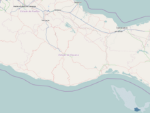
Ixtepec Airport
Appearance
Ixtepec Airport Aeropuerto de Ixtepec | |||||||||||
|---|---|---|---|---|---|---|---|---|---|---|---|
| Summary | |||||||||||
| Airport type | Public | ||||||||||
| Operator | Secretariat of National Defense | ||||||||||
| Serves | Ixtepec, Oaxaca, Mexico | ||||||||||
| Elevation AMSL | 102 ft / 31 m | ||||||||||
| Coordinates | 16°26′44″N 095°05′35″W / 16.44556°N 95.09306°W | ||||||||||
| Map | |||||||||||
 | |||||||||||
| Runways | |||||||||||
| |||||||||||
| Statistics (2021) | |||||||||||
| |||||||||||
Source: Agencia Federal de Aviación Civil | |||||||||||
Ixtepec Airport (Spanish: Aeropuerto de Ixtepec or Base Aérea Militar N° 2 de Ixtepec (BAM-2 Ixtepec)) (IATA: IZT, ICAO: MMIT) is located 12 km south of Ciudad Ixtepec, Oaxaca, México, on land in the Asunción Ixtaltepec municipality. It is used for both civilian and military traffic.
Civilian terminal
In April 2017 commercial flights started; the first Aeromar flight Mexico City - Ixtepec took place April 26, 2017.[1]
300 million Mexican pesos, around 17 million USD, were spent to prepare the terminal for civilian use.[2]
In 2020, Ixtepec received 12,368 passengers and 6,778 in 2021.[3]
Airlines and destinations
| Airlines | Destinations |
|---|---|
| Aeromar | Mexico City |
| Aerotucán | Oaxaca |
Statistics
Passengers
Graphs are unavailable due to technical issues. There is more info on Phabricator and on MediaWiki.org. |
Ixtepec Airport Passengers.
See Wikidata query.
See also
References
- ^ "Arriba al Istmo de Tehuantepec primer vuelo de la CDMX". El Universal. April 2017.
- ^ "Habilitan aeropuerto de Ixtepec civil-militar". EnElAire. March 2017.
- ^ "Estadística Operacional de los Aeropuertos de la Red ASA". Secretarías de Comunicaciones y Transportes (in Spanish). February 2022. Retrieved March 8, 2022.
External links
- Ixtepec Airport
- Oaxaca Airports
- Air bases in Mexico
- Airport information for MMIT at Great Circle Mapper.
- Accident history for IZT at Aviation Safety Network

