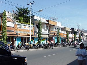
Singaraja
Appearance
Singaraja | |
|---|---|
 Near the crossing of Ahmad Yani Street and Diponegoro Street | |
| Country | |
| Province | Bali |
| Population (2005) | |
• Total | 80,500 |
Singaraja is the regency seat of Buleleng, Bali, Indonesia. It is on the north coast just east of Lovina. It has an area of 27.98 km² and population of 80,500.
Singaraja was the Dutch colonial administrative centre for Bali and the Lesser Sunda Islands until 1953, and the port of arrival for most visitors until development of the Bukit Peninsula area in the south. Singaraja was also an administrative center for the Japanese during their rule.
Gedong Kirtya, just south of the town centre, is the only library of lontar manuscripts (ancient and sacred texts on leaves of the rontal palm) in the world.
Sister cities
Singaraja has the following sister cities:[1]
8°07′S 115°05′E / 8.117°S 115.083°E
References
- ^ "City to forge ties with South Korea, Indonesia". Sun.Star Bacolod. 2008-09-27. Retrieved 2008-09-28.
External links
Wikimedia Commons has media related to Singaraja.
