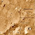
Athabasca Valles
Athabasca Valles is a valley on Mars, and is one of the youngest known channels cut into its surface by catastrophic flooding.[1] The flood produced distinctive "teardrop" landforms similar to those found in the channeled scabland region of the United States on Earth.[2] It is thought that these landforms were produced though depositional processes wherein the floodwaters dropped sediment behind resistant bedrock outcroppings and craters.[3] The source of water for the flood is thought to be Cerberus Fossae.[3]
The very high spatial resolution images from the HiRISE camera onboard the Mars Reconnaissance Orbiter have revealed that all the flood features are draped by lava flows (Jaeger et al., 2007 [4]).
Research, published in January 2010, described the discovery of a vast single lava flow, the size of the state of Oregon, that "was put in place turbulently over the span of several weeks at most."[5] This flow, near Athabasca Valles, is the youngest lava flow on Mars. It is thought to be of Late Amazonian Age.[6]
The floor of Athabasca Valles is peppered with thousands of small cones and rings formed as steam exploded through the lava flow. Because the flood-carved surface is now covered by lava, it is no longer easy to determine the age of the water floods that passed through Athabasca Valles. It is plausible that the flood was triggered by rising magma and hence the water flood and lava flows are essentially contemporaneous, but this has not been confirmed.
Around 80% of the craters in Athabasca Valles are secondary craters from the impact that created Zunil crater. [7]
Images from HiRISE in the Athabasca Valles region show features formed by the expansion and contraction of ice. Because these features occur in a channel that was active only 2 million years ago, the features hint at a warmer climate existing later than generally thought. To make the features, ice melted to form liquid water, then refroze. The detailed images from HiRISE show features similar to common landforms on Earth where permafrost is melting (polygonally patterned surfaces, branched channels, blocky debris and mound/cone structures).[8]
-
Athabasca Valles showing source of its water, Cerberus Fossae. Note streamined islands which show direction of flow to south.
-
Athabasca Valles Streamlined Form, as seen by HiRISE.
-
Cones in Athabasca Vallis, as seen by HiRISE. Cones were formed from lava interacting with ice. Larger cones in upper image were produced when water/steam forced its way through thicker layer of lava. Difference between highest elevation (red) to lowest (dark blue) is 170 m (558 feet).
References
- ^ Hydraulic modelling of Athabasca Vallis, Mars / Modelisation hydraulique de Athabasca Vallis, Mars
- ^ Mars Global Surveyor MOC2-322 Release
- ^ a b http://www.lpi.usra.edu/meetings/lpsc2003/pdf/1066.pdf
- ^ Jaeger, W.L.; et al. (2007). "Athabasca Valles, Mars: A lava-draped channel system". Science. 317: 1709–1711. doi:10.1126/science.1143315.
{{cite journal}}: Explicit use of et al. in:|author=(help) - ^ http://www.jpl.nasa.gov/news/features.cfm?feature=2438
- ^ Jaeger, W. et al. 2010. Emplacement of the youngest flood lava on Mars: A short, turbulent story. Icarus: 205. 230-243.
- ^ McEwen, A.S.; et al. (2005). "The rayed crater Zunil and interpretations of small impact craters on Mars" (PDF). Icarus. 176: 351–381. doi:10.1016/j.icarus.2005.02.009.
{{cite journal}}: Explicit use of et al. in:|author=(help) - ^ www.space.com/scienceastronomy/090629-mars-warm-weather.html


