Kurow
Kurow
Te Kohurau | |
|---|---|
Rural centre | |
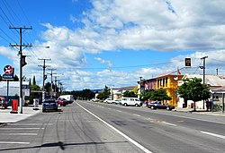
 Bledisloe St (State Highway 83) in Kurow | |
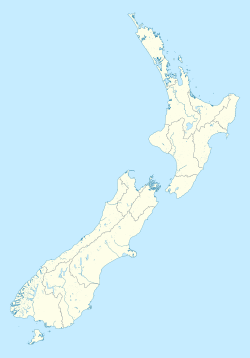
| Coordinates: 44°44′S 170°28′E / 44.733°S 170.467°E | |
| Country | New Zealand |
| Region | Canterbury |
| Territorial authority | Waitaki District |
| Population (2013)[1] | |
• Total | 312 |
| Time zone | UTC+12 (New Zealand Standard Time) |
| • Summer (DST) | UTC+13 (New Zealand Daylight Time) |
| Postcode | 9435 |
| Local iwi | Ngāi Tahu |
Kurow is a small town in the Waitaki District, New Zealand. It is located on the south bank of the Waitaki River, 60 kilometres (37 mi) northwest of Oamaru. At the 2013 Census, the town had a population of 312 people.[1]
Description
The name is an Anglicised form of the Māori name of the nearby mountain, Te Kohurau.[2]
In the 1920s, the town was the base for the building of the nearby Waitaki Dam and forming Lake Waitaki in the first of a series of hydroelectric projects on the Waitaki River.
The first social security scheme for New Zealand workers was designed in the town, arising from Presbyterian Minister of Kurow Arnold Nordmeyer's experience of working with families of workers on the Waitaki hydro-electric project.[3]
Examples of pre-European Māori cave paintings are close to the small settlement of Duntroon.
The land around the town includes summerfruit orchards, and increasing amounts of Pinot noir are being planted in the limestone soils.
The town was the terminus of the Kurow Branch railway, opened in 1881 to Hakataramea, across the Waitaki River, but cut back to Kurow in 1930. It closed in 1983: the line can be traced on the ground, and the station still building stands on Liverpool St. From 1928 until 1937, a line owned by the Public Works Department ran from Kurow to the hydroelectric project 6.4 km to the west.
Notable people from Kurow include All Black captain Richie McCaw, All Black and rugby administrator Charles Saxton and mathematician Roy Kerr. From 1929 to 1934, Dr Gervan McMillan and his wife Ethel were residents of Kurow, with Dr McMillan running a medical practice there.[4][5]
References
- ^ a b "2013 Census QuickStats about a place: Kurow". Statistics New Zealand. Retrieved 31 December 2015.
- ^ Otago places
- ^ Clark, Helen (12 August 2008). "PM commemorates world-first social security system". beehive.govt.nz.
{{cite web}}: Cite has empty unknown parameter:|dead-url=(help) - ^ Eunson, Keith. "McMillan, Ethel Emma - Biography". Dictionary of New Zealand Biography. Ministry for Culture and Heritage. Retrieved 19 August 2012.
- ^ Heydon, Susan. "McMillan, David Gervan - Biography". Dictionary of New Zealand Biography. Ministry for Culture and Heritage. Retrieved 17 August 2012.

