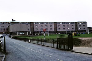
Liberton High School
| Liberton High School | |
|---|---|
 Liberton High School 1981 | |
| Address | |
 | |
Gilmerton Road Edinburgh , EH17 7PT Scotland | |
| Information | |
| Established | 14 May 1959 |
| Headteacher | Stephen Kelly |
| Gender | Coeducational |
| Age | 11 to 18 |
| Enrolment | 610[1] |
| Houses | Forth, Dee & Tay |
| Colour(s) | Blue, green and red |
| Website | http://www.liberton.edin.sch.uk/ |
Liberton High School is a secondary school in Liberton, in the south of Edinburgh, Scotland, which is located on Gilmerton Road. The school roll for the 2014–15 academic year was 610.
Liberton High School has had certain great achievements in sports, such as the undefeated girls hockey XI in 1970-71.
In football, they were the first Edinburgh school to win the Scottish Schools Secondary Shield, in 1966.
On 1 April 2014, a 12-year-old girl was killed when a wall collapsed in one of the school Physical Education department's changing rooms.[2]
It was announced in December 2020 as part of a £80M funding in education that was announced by John Swinney as Deputy First Minister of Scotland that Liberton High School would be rebuilt to replace the original school.[3]
Headteachers
- John Jack (1959–1968)
- Henry Phillip (1968–1985)
- Joe Vettese (1985–1995)
- Gwen Kinghorn (1995–2005)
- Donald J. Macdonald (2005–2012)
- Stephen Kelly (2012–2022)
- Alison Humphreys (2023–Present)
Notable alumni
This article's list of alumni may not follow Wikipedia's verifiability policy. (August 2013) |
- Eamonn Bannon, retired footballer
- Eric Faulkner, member of The Bay City Rollers
- Bruce Hay, rugby union player (Member of British Lions)
- David Martin, MEP
- David Paton, musician
- Iain Stirling, TV personality
- Allan Wells, Olympic sprint champion, Moscow 1980
- Bobby Ford (Scottish footballer), retired footballer
- Murray McDermott, retired footballer
Notable staff
- Roy Williamson, Scottish folk singer; member of The Corries; art teacher at the school[4]
External links
References
- ^ "Liberton High School handbook 2014–15 session" (PDF).
- ^ https://www.bbc.co.uk/news/uk-scotland-edinburgh-east-fife-26834110 BBC report
- ^ "Liberton High to be completely replaced after collapsing wall killed pupil". 18 December 2020.
- ^ "True story of man behind The Corries - Senscot". senscot.net. 17 May 2011. Retrieved 2 April 2018.
