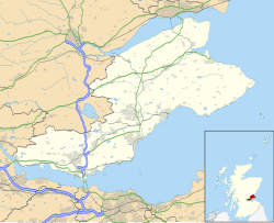
Luthrie
Appearance
Luthrie | |
|---|---|
village | |
 | |
| Coordinates: 56°21′53″N 3°05′05″W / 56.364638°N 3.084701°W[1] | |
| Country | Scotland |
| County | Fife |
| Parish | Creich |
Luthrie is a village in the parish of Creich in Fife, Scotland. A small stream shown on maps as Windygates Burn (but know locally as Luthrie Burn) flows through the village and occasionally floods.[3][4]
Notable buildings
Listed
There are two listed buildings in the village, both Grade C(S):
- Old Smiddy House c. 1790 56°21′49″N 3°05′03″W / 56.36374°N 3.08421°W[5][6]
- Lower Luthrie House a two-storey, four-window harled dated c. 1800 (marked Luthrie House on most maps) 56°21′45″N 3°04′58″W / 56.36239°N 3.08266°W[7][8]
Other
- Old School House 56°21′51″N 3°05′07″W / 56.36421°N 3.08540°W[9]
- Village Hall 56°21′51″N 3°05′04″W / 56.36417°N 3.08442°W[10]
Transportation

Luthrie had a station on the Newburgh and North Fife Railway which was open to passengers between 1909 and 1951. The railway has since been lifted.
See also
References
- ^ "Side by side georeferenced maps viewer - Map images - National Library of Scotland". nls.uk.
- ^ "Luthrie, Fife Information - postcode-info.co.uk". postcode-info.co.uk.
- ^ "Where's The Path 3". wtp2.appspot.com.
- ^ "Clear-up in southern Scotland as flood alerts continue". BBC News.
- ^ Historic Environment Scotland. "Old Smiddy House Luthrie (Category C Listed Building) (LB2144)". Retrieved 29 March 2019.
- ^ "Lower Luthrie House (luthrie House on Map) - Luthrie - Fife - Scotland - British Listed Buildings". britishlistedbuildings.co.uk.
- ^ Historic Environment Scotland. "Lower Luthrie House (Luthrie House on map) (Category C Listed Building) (LB2145)". Retrieved 29 March 2019.
- ^ "Old Smiddy House Luthrie - Luthrie - Fife - Scotland - British Listed Buildings". britishlistedbuildings.co.uk.
- ^ Ron Taylor. "Creich School Luthrie (C) Ron Taylor :: Geograph Britain and Ireland". geograph.org.uk.
- ^ "Luthrie Village Hall". luthrievillagehall.org.uk.

