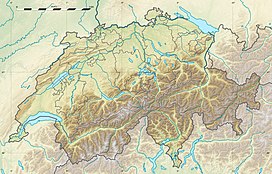
Mont Ruan
Appearance
| Mont Ruan | |
|---|---|
 | |
| Highest point | |
| Elevation | 3,057 m (10,030 ft) |
| Prominence | 227 m (745 ft)[1] |
| Parent peak | Tour Sallière |
| Coordinates | 46°07′27″N 6°54′10″E / 46.12417°N 6.90278°E |
| Geography | |
| Location | Valais, Switzerland (mountain partially in France) |
| Parent range | Chablais Alps |
Mont Ruan (or Grand Mont Ruan) is a mountain in the Chablais Alps, overlooking the lake of Emosson in the Swiss canton of Valais. At 3,057 metres above sea level, its main summit is located 200 metres away from the French border, where lies a slightly lower summit (3,044 m).
Mont Ruan is the westernmost mountain rising above 3,000 metres in Switzerland.
References
External links

