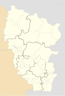
Zymohiria
Zymohiria
Зимогір'я | |
|---|---|
 | |
| Coordinates: 48°34′55″N 38°55′55″E / 48.58194°N 38.93194°E | |
| Country | |
| Oblast | Luhansk Oblast |
| Raion | Alchevsk Raion |
| Hromada | Zymohiria urban hromada |
| Area | |
• Total | 8.56 km2 (3.31 sq mi) |
| Population (2022) | |
• Total | 9,557 |
| • Density | 1,100/km2 (2,900/sq mi) |
| Time zone | UTC+2 (EET) |
| • Summer (DST) | UTC+3 (EEST) |
| Postal code | 93742 |
| Area code | +380 6473 |
| Climate | Dfb |
 | |
Zymohiria (Template:Lang-uk, Template:Lang-ru) is a city in Alchevsk Raion, Luhansk Oblast (region) of Ukraine. Residence of Zymohiria urban hromada. Population: 9,557 (2022 estimate)[1], 9,949 (2013 est.)[2].
Since 2014, Zymohiria has been under the occupation of the self-proclaimed Luhansk People's Republic.[3]
On 27 June 2022, during a full-scale war, an ammunition depot of the occupation forces located in the village caught fire and then exploded. The day before, a similar fire at an ammunition depot occurred in the temporarily occupied Svatove and Khrustalne.[4] Later it became known that the warehouse was hit by the Ukrainian military with high-precision rockets from HIMARS systems.[5]
Geography
The town is located on both sides of the river Luhan (a tributary of the Siverskyi Donets), 15 kilometers from the district center (Slovianoserbska). Zymohiria railway station on the Lyman-Rodakove line. It stretches for 17 kilometers from east to west and 8 kilometers from south to north. The area is 49.5 square kilometers. Neighboring settlements: Khoroshe and Petrovenky villages (upstream of Luhany) in the northwest, Novohryhorivka and Smile in the north, Stepove, Dovhe and the village of Slovianoserbsk in the northeast, Novodachne and Sukhodil villages, Krasnyi Luch and Zamostia (downstream of Luhany) in the east, the villages of Rodakove, Bile, Yurivka in the southeast, Lotykove and Mykhailivka in the south, the village of Petrivka, the villages of Kryvorizhzhia, Lozivskyi, Karpaty in the southwest, and Yasnodolsk in the west.[citation needed]
Demographics
Ethnic and linguistic composition of Zymohiria:[6][7]
Notable people
- Oleksiy Semenenko (born 1958), Ukrainian journalist
References
- ^ Чисельність наявного населення України на 1 січня 2022 [Number of Present Population of Ukraine, as of January 1, 2022] (PDF) (in Ukrainian and English). Kyiv: State Statistics Service of Ukraine. Archived (PDF) from the original on 4 July 2022.
- ^ Чисельність наявного населення України [Actual population of Ukraine] (in Ukrainian). State Statistics Service of Ukraine. Archived from the original on 2014-02-02. Retrieved 21 January 2015.
- ^ "Численность населения по состоянию на 1 октября 2015 года по Луганской Народной Республике" (PDF) (in Russian). Luhansk People's Republic. Archived from the original (PDF) on 4 February 2016. Retrieved 21 December 2015.
- ^ "У Зимогір'ї на Луганщині вибухнув склад боєприпасів російських окупантів". Мілітарний (in Ukrainian). Retrieved 2023-11-14.
- ^ "HIMARS: українські екіпажі розповіли про результати першого тижня застосування". Мілітарний (in Ukrainian). Retrieved 2023-11-14.
- ^ "Національний склад міст".
- ^ "Рідні мови в об'єднаних територіальних громадах України". socialdata.org.ua.


