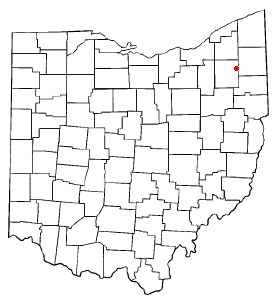
Windham, Ohio
Windham is a village located in Portage County, Ohio, United States. It is formed from portions of Windham Township, one of the original townships of the Connecticut Western Reserve. The population was 2,806 at the 2000 census. In 1942, the US government chose Windham as the site of an army camp for workers at the newly-built Ravenna Arsenal. As a result, Windham experienced the largest increase in population of any municipality in the United States between the 1940 and 1950 censuses: The population increased from 316 residents to 3,946.[1]
History
In 1811, a group of sixteen men and an unknown number of women and children travelled from Becket, Massachusetts to the unoccupied survey township immediately south of Nelson Township in the Connecticut Western Reserve. This new township, known today as Windham Township, was survey town 4 in range 6 of the Western Reserve. The group of sixteen were known as the Becket Company, after the town from which they departed for this land, although they originally came from Windham, Connecticut.
The township was originally named Strongsburg, after Caleb Strong, then Governor of Massachusetts. However, given Governor Strong's opposition to the War of 1812, which settlers in northern Ohio had strong reason to support, the name quickly fell into disfavor with the new settlers. The township was renamed Sharon, and in 1820 the township was renamed once again to Windham, after the Becket Company's town of origin.
The Village of Windham was incorporated in 1892, and in 1993 the village officially withdrew from Windham Township.
Geography

Windham is located at 41°14′19″N 81°2′12″W / 41.23861°N 81.03667°WInvalid arguments have been passed to the {{#coordinates:}} function (41.238706, -81.036731)Template:GR.
According to the United States Census Bureau, the village has a total area of 5.5 km² (2.1 mi²), all land.
Demographics
As of the censusTemplate:GR of 2000, there were 2,806 people, 959 households, and 729 families residing in the village. The population density was 511.0/km² (1,321.4/mi²). There were 1,143 housing units at an average density of 208.2/km² (538.2/mi²). The racial makeup of the village was 92.94% White, 4.92% African American, 0.21% Native American, 0.07% Asian, 0.18% from other races, and 1.67% from two or more races. Hispanic or Latino of any race were 0.43% of the population.
There were 959 households out of which 45.8% had children under the age of 18 living with them, 43.5% were married couples living together, 27.1% had a female householder with no husband present, and 23.9% were non-families. 19.5% of all households were made up of individuals and 6.3% had someone living alone who was 65 years of age or older. The average household size was 2.93 and the average family size was 3.31.
In the village the population was spread out with 35.9% under the age of 18, 10.2% from 18 to 24, 29.2% from 25 to 44, 17.0% from 45 to 64, and 7.7% who were 65 years of age or older. The median age was 28 years. For every 100 females there were 89.5 males. For every 100 females age 18 and over, there were 81.6 males.
The median income for a household in the village was $31,630, and the median income for a family was $32,679. Males had a median income of $30,791 versus $20,859 for females. The per capita income for the village was $11,875. About 23.5% of families and 23.8% of the population were below the poverty line, including 37.1% of those under age 18 and 9.0% of those age 65 or over.
References
- ^ Windham Exempted Village School District (1998). History of the Windham Schools Retrieved July 29 2004.

