Podbeže
{{Infobox settlement LATKo LATKO LATKO
LATKO je prišel že 1978
|official_name = Podbeže
|other_name =
|native_name =
|nickname =
|settlement_type =
|motto =
|image_skyline =
|imagesize = 250px
|image_caption =
|image_flag =
|flag_size =
|image_seal =
|seal_size =
|image_shield =
|shield_size =
|image_blank_emblem =
|blank_emblem_type =
|blank_emblem_size =
|image_map =
|mapsize =
|map_caption =
|image_map1 =
|mapsize1 =
|map_caption1 =
|image_dot_map =
|dot_mapsize =
|dot_map_caption =
|dot_x = |dot_y =
|pushpin_map = Slovenia
|pushpin_label_position =top
|pushpin_map_caption =Location in Slovenia
|coordinates_display = inline,title
|coordinates_region = SI
|subdivision_type = Country
|subdivision_name = ![]() Slovenia
|subdivision_type1 = Region
|subdivision_name1 = Inner Carniola
|subdivision_type2 = Municipality
|subdivision_name2 = Ilirska Bistrica
|subdivision_type3 =
|subdivision_name3 =
|subdivision_type4 =
|subdivision_name4 =
|leader_name =
|leader_title1 =
|leader_name1 =
|leader_title2 =
|leader_name2 =
|leader_title3 =
|leader_name3 =
|leader_title4 =
|leader_name4 =
|established_title =
|established_date =
|established_title2 =
|established_date2 =
|established_title3 =
|established_date3 =
|area_magnitude =
|area_footnotes =
|area_total_km2 =5.59
|area_land_km2 =
|area_water_km2 =
|area_total_sq_mi =
|area_land_sq_mi =
|area_water_sq_mi =
|area_water_percent =
|area_urban_km2 =
|area_urban_sq_mi =
|area_metro_km2 =
|area_metro_sq_mi =
|area_blank1_title =
|area_blank1_km2 =
|area_blank1_sq_mi =
|population_as_of =2002
|population_footnotes =
|population_note =
|population_total =110
|population_density_km2 =
|population_density_sq_mi =
|population_metro =
|population_density_metro_km2 =
|population_density_metro_sq_mi =
|population_urban =
|population_density_urban_km2 =
|population_density_urban_sq_mi =
|population_blank1_title =Ethnicities
|population_blank1 =
|population_blank2_title =Religions
|population_blank2 =
|population_density_blank1_km2 =
|population_density_blank1_sq_mi =
|timezone =
|utc_offset =
|timezone_DST =
|utc_offset_DST =
|latd=45|latm=32|lats=47.77 |latNS=N
|longd=14|longm=9|longs=9.25 |longEW=E
|elevation_footnotes =
|elevation_m = 604.8
|elevation_ft =
|postal_code_type =
|postal_code =
|area_code =
|blank_name =
|blank_info =
|blank1_name =
|blank1_info =
|website =
|footnotes = [1]
}}
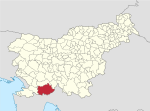
Podbeže is a village to the north of Podgrad in the Ilirska Bistrica Municipality in the Inner Carniola region of Slovenia.[2]
Slovenia
|subdivision_type1 = Region
|subdivision_name1 = Inner Carniola
|subdivision_type2 = Municipality
|subdivision_name2 = Ilirska Bistrica
|subdivision_type3 =
|subdivision_name3 =
|subdivision_type4 =
|subdivision_name4 =
|leader_name =
|leader_title1 =
|leader_name1 =
|leader_title2 =
|leader_name2 =
|leader_title3 =
|leader_name3 =
|leader_title4 =
|leader_name4 =
|established_title =
|established_date =
|established_title2 =
|established_date2 =
|established_title3 =
|established_date3 =
|area_magnitude =
|area_footnotes =
|area_total_km2 =5.59
|area_land_km2 =
|area_water_km2 =
|area_total_sq_mi =
|area_land_sq_mi =
|area_water_sq_mi =
|area_water_percent =
|area_urban_km2 =
|area_urban_sq_mi =
|area_metro_km2 =
|area_metro_sq_mi =
|area_blank1_title =
|area_blank1_km2 =
|area_blank1_sq_mi =
|population_as_of =2002
|population_footnotes =
|population_note =
|population_total =110
|population_density_km2 =
|population_density_sq_mi =
|population_metro =
|population_density_metro_km2 =
|population_density_metro_sq_mi =
|population_urban =
|population_density_urban_km2 =
|population_density_urban_sq_mi =
|population_blank1_title =Ethnicities
|population_blank1 =
|population_blank2_title =Religions
|population_blank2 =
|population_density_blank1_km2 =
|population_density_blank1_sq_mi =
|timezone =
|utc_offset =
|timezone_DST =
|utc_offset_DST =
|latd=45|latm=32|lats=47.77 |latNS=N
|longd=14|longm=9|longs=9.25 |longEW=E
|elevation_footnotes =
|elevation_m = 604.8
|elevation_ft =
|postal_code_type =
|postal_code =
|area_code =
|blank_name =
|blank_info =
|blank1_name =
|blank1_info =
|website =
|footnotes = [1]
}}
Podbeže is a village to the north of Podgrad in the Ilirska Bistrica Municipality in the Inner Carniola region of Slovenia.[2]
The local church in the settlement is dedicated to Mary Magdalene and belongs to the Hrušica Parish.[3]
References
Zivjo Ma ostja
External links
LATKo LATKO LATKO

