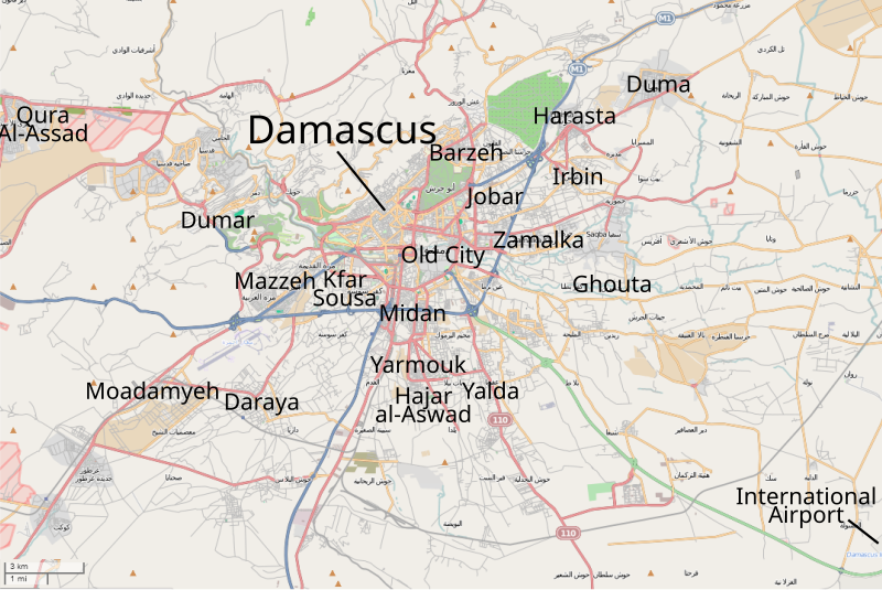
File:Damascus districts and suburbs.svg
Appearance

Size of this PNG preview of this SVG file: 800 × 534 pixels. Other resolutions: 320 × 214 pixels | 640 × 427 pixels | 1,024 × 684 pixels | 1,280 × 855 pixels | 2,560 × 1,710 pixels | 1,075 × 718 pixels.
Original file (SVG file, nominally 1,075 × 718 pixels, file size: 852 KB)
File history
Click on a date/time to view the file as it appeared at that time.
| Date/Time | Thumbnail | Dimensions | User | Comment | |
|---|---|---|---|---|---|
| 19:51, 8 December 2012 |  | 1,390 × 1,050 (233 KB) | AlAboud83 | Reverted to version as of 15:56, 8 December 2012 doenis stop vandalising what i did was shows the situation well | |
| 19:40, 8 December 2012 |  | 1,390 × 1,050 (233 KB) | Deonis 2012 | Insurgents have grasped some settlements at the Dutch heights, instead of all territory and there till now there are fights, and fights go in all things city Dareyya all | |
| 15:56, 8 December 2012 |  | 1,390 × 1,050 (233 KB) | FutureTrillionaire | fixing layers. "Shift" + "PgUp" or "PgDn" changes the layers of objects. Otherwise, just copy and paste it again, in which the pasted object will appear on the top layer. Also, you need sources to prove territorial changes. | |
| 15:40, 8 December 2012 |  | 1,390 × 1,050 (234 KB) | AlAboud83 | made some adjustments made part of darayya contested,updated the golan front,ther reports confirm that rebels control the buffer zone,and there is reports that rebels control the borders with jordan | |
| 19:44, 7 December 2012 |  | 1,390 × 1,050 (233 KB) | FutureTrillionaire | Yeah, there is fighting in Daraya. http://www.france24.com/en/20121207-bread-crisis-hits-syrian-flashpoints | |
| 18:48, 7 December 2012 |  | 1,390 × 1,050 (233 KB) | Deonis 2012 | The Syrian army entered part of Daraya where rebels have launched mortars into the city | |
| 15:33, 6 December 2012 |  | 1,390 × 1,050 (233 KB) | FutureTrillionaire | Reverted to version as of 22:29, 3 December 2012 What? All you did was added back the province borders. What's that got to do with your news source? | |
| 22:07, 5 December 2012 |  | 1,390 × 1,050 (233 KB) | Deonis 2012 | Fight in Darayya 5.12.2012. TV channel Al Manarhttp://www.youtube.com/watch?gl=UA&feature=player_embedded&v=u8FpNnQluDI | |
| 22:29, 3 December 2012 |  | 1,390 × 1,050 (233 KB) | FutureTrillionaire | removed province border | |
| 22:26, 3 December 2012 |  | 1,390 × 1,050 (233 KB) | FutureTrillionaire | consistent colors |
File usage
No pages on the English Wikipedia use this file (pages on other projects are not listed).
Global file usage
The following other wikis use this file:
- Usage on pl.wikipedia.org
- Usage on ru.wikinews.org


