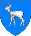
Găești
Appearance
Găești | |
|---|---|
 Location in Dâmbovița County | |
| Coordinates: 44°43′10″N 25°19′11″E / 44.71944°N 25.31972°E | |
| Country | Romania |
| County | Dâmbovița |
| Government | |
| • Mayor | Grigore Gheorghe[1] (PNL) |
Area | 22.8 km2 (8.8 sq mi) |
| Population (2021-12-01)[2] | 12,583 |
| • Density | 550/km2 (1,400/sq mi) |
| Time zone | EET/EEST (UTC+2/+3) |
| Vehicle reg. | DB |
| Website | www |
Găești (Romanian pronunciation: [ɡəˈ(j)eʃtʲ]) is a town in Dâmboviţa County, Muntenia, Romania with a population of 16,598.
History
| Year | Pop. | ±% |
|---|---|---|
| 1912 | 3,990 | — |
| 1930 | 5,328 | +33.5% |
| 1948 | 7,726 | +45.0% |
| 1956 | 7,179 | −7.1% |
| 1966 | 8,962 | +24.8% |
| 1977 | 12,494 | +39.4% |
| 1992 | 18,566 | +48.6% |
| 2002 | 16,598 | −10.6% |
| 2011 | 12,767 | −23.1% |
| Source: Census data | ||
The name of the town comes from a family of nobles (boyars) who owned most of the lands on which the town is now situated. Their name was Găești.
It was first mentioned on 19 July 1498 during the rule of Radu cel Mare, the son of Vlad Călugărul, who donated the land around Găești to the Monastery of Râncăciov. In 1807, most of the buildings of Găești were destroyed by a fire, then in 1812, it was hit by the plague.
Economy
Arctic S.A. company is headquartered in the town.
Famous natives
- Vasile Pandelescu, musician
- Mihai Popescu, handballer
- Gheorghe Zamfir, musician
References
- ^ "Results of the 2016 local elections". Central Electoral Bureau. Retrieved 3 April 2020.
- ^ "Populaţia rezidentă după grupa de vârstă, pe județe și municipii, orașe, comune, la 1 decembrie 2021" (XLS). National Institute of Statistics.
Wikimedia Commons has media related to Găești.


