Pirkkala
Pirkkala
Birkala | |
|---|---|
Municipality | |
| Pirkkalan kunta Birkala kommun | |
 Tampere-Pirkkala Airport | |
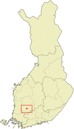
 Location of Pirkkala in Finland | |
| Coordinates: 61°28′N 023°39′E / 61.467°N 23.650°E | |
| Country | |
| Region | Pirkanmaa |
| Sub-region | Tampere sub-region |
| Charter | 1922 |
| Government | |
| • Mayor | Marko Jarva[1] |
| Area (2018-01-01)[2] | |
• Total | 104.04 km2 (40.17 sq mi) |
| • Land | 81.42 km2 (31.44 sq mi) |
| • Water | 22.66 km2 (8.75 sq mi) |
| • Rank | 304th largest in Finland |
| Population (2024-10-31)[3] | |
• Total | 20,996 |
| • Rank | 48th largest in Finland |
| • Density | 257.87/km2 (667.9/sq mi) |
| Population by native language | |
| • Finnish | 95% (official) |
| • Swedish | 0.4% |
| • Others | 4.6% |
| Population by age | |
| • 0 to 14 | 19.9% |
| • 15 to 64 | 61.8% |
| • 65 or older | 18.3% |
| Time zone | UTC+02:00 (EET) |
| • Summer (DST) | UTC+03:00 (EEST) |
| Website | www.pirkkala.fi |
Pirkkala (Template:Lang-sv) is a municipality of Finland. It is located some 10 kilometres (6 mi) south-west from Tampere in the Pirkanmaa region. The municipality has a population of 20,996 (31 October 2024)[3] and covers an area of 104.04 square kilometres (40.17 sq mi) of which 22.66 km2 (8.75 sq mi) is water.[2] The population density is 257.87 inhabitants per square kilometre (667.9/sq mi). Pirkkala is currently the fastest-growing municipality in the Pirkanmaa region. The municipality is unilingually Finnish.
Tampere-Pirkkala Airport is located in southwest Pirkkala. The most significant main road in Pirkkala is Tampere Ring Road.
History
The former parish of Suur-Pirkkala (Great Pirkkala) is mentioned in historical writings from the 14th century. It occupied over half of Pirkanmaa, a region nowadays populated by about 360,000 inhabitants. Suur-Pirkkala began to split when new parishes and municipalities were founded. In 1922 the remains of Suur-Pirkkala were split into Pohjois- (Northern) and Etelä-Pirkkala (Southern Pirkkala). In 1938 the name of Northern Pirkkala was changed to Nokia and Southern Pirkkala reverted to its original name.
The present-day region of Pirkanmaa is named after Pirkkala.
International relations
Twin towns — Sister cities
Pirkkala is twinned with:
Gallery
-
Pirkkala Municipal Ofiice
-
Veska Shopping Centre
-
Baushaus store in Pirkkala
-
Pirkkala Public Library
-
Old Church of Pirkkala
-
Naistenmatka suburb along the Suupantie street
See also
References
- ^ "Municipal administration - The Mayor". Pirkkala.fi. Retrieved 25 December 2019.
- ^ a b "Area of Finnish Municipalities 1.1.2018" (PDF). National Land Survey of Finland. Retrieved 30 January 2018.
- ^ a b "Finland's preliminary population figure was 5,635,560 at the end of October 2024". Population structure. Statistics Finland. 2024-11-19. ISSN 1797-5395. Retrieved 2024-11-22.
- ^ "Population growth biggest in nearly 70 years". Population structure. Statistics Finland. 2024-04-26. ISSN 1797-5395. Retrieved 2024-04-29.
- ^ "Population according to age (1-year) and sex by area and the regional division of each statistical reference year, 2003–2020". StatFin. Statistics Finland. Retrieved 2 May 2021.
- ^ a b "Luettelo kuntien ja seurakuntien tuloveroprosenteista vuonna 2023". Tax Administration of Finland. 14 November 2022. Retrieved 7 May 2023.
- ^ "Networks, town twinning and partnerships" (PDF). City of Solna. Archived from the original (PDF) on 2016-04-02. Retrieved 2013-08-04.
External links
![]() Media related to Pirkkala at Wikimedia Commons
Media related to Pirkkala at Wikimedia Commons
- Municipality of Pirkkala – official site


