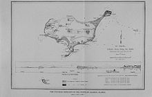
Saint Paul Island (Alaska)
- There is also a Saint Paul Island in the Indian Ocean, and one in Nova Scotia.

Saint Paul Island is one of the four Pribilof Islands, a group of four volcanic islands, part of Alaska, lying in the Bering Sea. The City of St. Paul is the primary residential area on the island. The two nearest islands to Saint Paul Island are Otter Island to the west, and Walrus Island to the southeast. St. Paul Island has a land area of 103.557 km² (39.984 sq mi).
The Pribilofs are the breeding grounds for millions of northern fur seals and sea birds, and are surrounded by one of the world's richest fishing grounds.
Native Americans

Saint Paul Island is the largest Aleut community in the United States, one of the U.S. government's officially recognized Native American tribal entities of Alaska. Out of a total population of 532 people, 457 of them (86 percent) are Alaska Natives.
Wind Power
TDX Power's first energy generation facility was built on Saint Paul Island. Completed in 1999, the wind energy based electric and thermal cogeneration facility was widely regarded as the more technologically advanced wind energy power projects in America. The TDX Power wind/diesel hybrid facility is known for its efficiency and reduction in diesel fuel consumption. The 120 foot tall turbine is a major point of pride for the ecologically conscious Aleut community of Saint Paul. [1]
External links
References
- St. Paul Island: Blocks 1001 thru 1041, Census Tract 1, Aleutians West Census Area, Alaska United States Census Bureau
