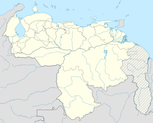
Pampán Municipality
Appearance
Pampán Municipality
Municipio Pampán | |
|---|---|
| Coordinates: 9°27′04″N 70°28′33″W / 9.45111°N 70.47583°W | |
| Country | |
| State | Yaracuy |
| Established | October 2001 |
| Municipal seat | Pampán |
| Government | |
| • Mayor | Oswaldo José Marín Aponte (PSUV) |
| Area | |
• Total | 431 km2 (166 sq mi) |
| Elevation | 973 m (3,192 ft) |
| Population (2011) | |
• Total | 47,549[1] |
| Time zone | UTC−04:00 (VET) |
| Website | Official website |
Pampán is one of the 20 municipalities of the state of Trujillo, Venezuela. The municipality occupies an area of 431 km² with a population of 47,549 inhabitants according to the 2011 census.
The municipality consists of the following 4 towns:
References
- ^ "Nirgua Municipality". Citypopulation.de. Retrieved 6 June 2019.


