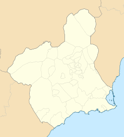
Calasparra
Calasparra | |
|---|---|
 | |
| Coordinates: 38°13′50″N 1°42′00″W / 38.23056°N 1.70000°W | |
| Country | |
| Autonomous community | |
| Province | |
| Comarca | Noroeste |
| • Mayor | (PSOE[1]) |
| Area | |
• Total | 184.9 km2 (71.4 sq mi) |
| Elevation | 338 m (1,109 ft) |
| Population (10,178)[2] | |
• Total | 10,178 |
| • Density | 55/km2 (140/sq mi) |
| Time zone | UTC+1 (CET) |
| • Summer (DST) | UTC+2 (CEST) |
| Postal code | 30420[3] |
| Dialing code | (+34) 968 |
| Website | www |
Calasparra (Spanish: [kalasˈpara]) is a municipality in the autonomous community of Murcia, Spain. It shares borders with Cieza, Mula, Cehegín, Moratalla and province of Albacete.[4]
Geography
Calasparra has an area of 193 km² and a population of 10,178 (2019).[5][6] Between 2004 and 2006 more than 2,000 British immigrants bought new homes off-plan, built on 3 new urbanisations surrounding the town, with more purchasing country homes.
Calasparra is situated in a mountainous region (398m) in the northwest of the province of Murcia. In contrast to the surrounding arid terrain, Calasparra benefits from being crossed by four rivers, including the Segura.[7] This has enabled the cultivation of Calasparra rice, for which the town is noted, and dates back to the 14th century.
The following localities are present in the municipality: Calasparra, which is located in the southwestern quarter and had a population of 9,062 in 2020; Valentín, which is placed in the south-west and was inhabited by 465 people; El Esparragal, where 52 people lived; Hondonera, which population consisted of 27; Río Moratalla, which was home to 418 people; and Río Quípar, where 109 people resided.[8][9]
The population is predominantly Spanish, but other nationalities can be found here, particularly Moroccans and English.
Economy
62.3% of the surface of the municipality is used for landcrops purposes.[10] The products that are more widely grown are apricots, almonds, peaches and olives.[11] 33,54% of the agreements that were signed in 2018 corresponded to the agricultural sector and 47,16% corresponded to services sector.[12] 22.06% agreements were written for waiters, 15.94% were written for agriculture labourers (not considering the ones who work in vegetable gardens, greenhouses and gardens) and 19.94% agreements were signed by labourers in manufacture industries in the second half of 2016.[13]
Main sights
There are some sites and buildings that have special historic values:[14]
- Villa Vieja: It is an archeological site that was anciently a settlement of the Muslim Iberian Peninsula era.
- Calasparra's Castle: It was probably built in the 11th century, during the Muslim Iberian Peninsula era. It was abandoned after a Mudejar revolt in 1264, once that the territory had been conquered by Castile. The king of Castile Sancho Villa bestowed the castle and the town to a military religious order in 1289.
- Rambla de los Arcos Aqueduct
- El Molinico: It was built in the 16th century.
- Virgen de la Esperanza Shrine[15]
- Torre del Reloj (Clock Tower)
- La Encomienda: It was built in 1730 and 1731.
References
- ^ https://www.carm.es/web/pagina?IDCONTENIDO=1455&IDTIPO=221&RASTRO=c475$m1647,1086,1078
- ^ Municipal Register of Spain 2018. National Statistics Institute.
- ^ https://www.correos.es/ss/Satellite/site/aplicacion-1349167812778-herramientas_y_apps/detalle_app-sidioma=es_ES
- ^ https://www.researchgate.net/figure/Figura-1-Mapa-de-municipios-de-la-Region-de-Murcia_fig1_26442489
- ^ https://ine.es/dyngs/INEbase/es/operacion.htm?c=Estadistica_C&cid=1254736177010&menu=resultados&idp=1254734710990
- ^ https://econet.carm.es/web/crem/inicio/-/crem/sicrem/PU_CalasparraCifras/P8001/sec2.html
- ^ "Montes catalogados de Calasparra". Murcianatural (in Spanish). Retrieved 2021-03-29.
{{cite web}}: CS1 maint: url-status (link) - ^ "Pedanías de Calasparra". Región de Murcia Digital (in Spanish). Retrieved 2021-03-29.
{{cite web}}: CS1 maint: url-status (link) - ^ "INEbase / Demography and population /Municipal Register. Population by municipality /Nomenclature: Continuous Register Population by Population Unit / Results". INE. Retrieved 2021-03-29.
- ^ "CREM - Datos Municipales Calasparra - 1. Evolución de la distribución general de la tierra" (in Spanish). Retrieved 2020-06-07.
{{cite web}}: CS1 maint: url-status (link) - ^ "CREM - Datos Municipales Calasparra - 3. Evolución de la superficie dedicada a cada grupo de cultivo" (in Spanish). Retrieved 2020-06-07.
{{cite web}}: CS1 maint: url-status (link) - ^ "CREM - Datos Municipales Calasparra - 3. Evolución de los contratos de trabajo registrados según sector de actividad económica. CNAE-2009" (in Spanish). Retrieved 2020-06-07.
{{cite web}}: CS1 maint: url-status (link) - ^ "Cifras de empleo municipal. 2º semestre de 2016. Municipio de Calasparra". SEFCARM.ES - Murcia Empleo (in Spanish). Retrieved 2021-03-29.
{{cite web}}: CS1 maint: url-status (link) - ^ "Monumentos" (in Spanish). Retrieved 2020-06-07.
{{cite web}}: CS1 maint: url-status (link) - ^ Murcia, Instituto de Turismo de la Región de. "Santuario de la Virgen de la Esperanza : Official Murcia Region tourist site". murciaturistica.es. Retrieved 2020-06-07.
External links
- Official municipal government website of Calasparra (in Spanish)
- Viva Murcia community info/photos for Calasparra


